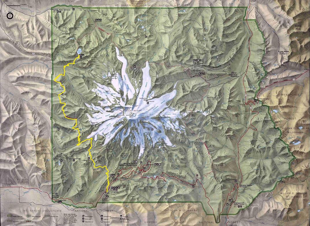
West Side - Longmire to Mowich Lake
Mount Rainier Map
1
2
3
4
5
55
54
50
25
20
22
37
38
33
Home
WillhiteWeb.com

Mount Rainier National Park Trips

WA Hikes & Climbs
The numbers correspond to the map on the page. These are the trip reports I have pages for.
30
52
57
21
56
27
26
7
53
51
14
10
23
28
12
11
6
13
60
31
34
35
36
Preparing for Rainier
Hiking to Camp Muir
The Paradise Area
Ski The Nisqually
4) Hessong Rock and Mount Pleasant
6) Ptarmigan Ridge
25) Sourdough Mountains, Palisades Trail
20) Little Tahoma Climb
22) Tamanos Mountain
37) Shriner Peak
38) Double Peak
33) Chinook Peak
3) Paul Peak and Elizabeth Ridge
1) Tolmie Peak Trail
2) Martin, Virginia, Berry, August Peaks
50) Unicorn Peak
55) Lake George Trail
54) Indian Henrys Hunting Ground, Ararat, Copper & Iron Mountains
26) McNeeley Peak
27) Freemont & Skyscraper Mountains
56) Mount Wow
21) Summerland Trail
7) Knapsack Pass
53) Pyramid Peak
51) Pinnacle Saddle Trail - Pinnacle & Castle Peaks
14) Sluiskin Mountain
10) Green Lake Trail, Gove, Arthur Peaks
23) Goat Island Mountain
28) Burroughs Mountains
East Side - Summerland to Box Canyon
12) Carbon River Glacier Trail
11) Chenuis Falls Trail
30) Grand Park - Back Entrance
57) Tumtum Mountain
52) Lane Peak
13) Old Desolate
5) Observation & Echo Rock
36) Dewey Peak
35) Naches Peak
34) Yakima Peak
31) Crystal Mountain - Silver King
60) Mount Rainier Summit
Carbon River Entrance
Other pages I have made:
Mowich Lake Entrance
Nisqually Entrance
White River Entrance
Highway 410 Access
15) Windy Gap area
16) Crescent Mountain
15
16
Wonderland Trail
A) Colonnade Lookout
B) Sunset Park Lookout
Historic Former Lookout Sites
C) Anvil Rock Lookout
A
B
C
24) Dege Peak
24
32
32) Crystal Peak
39) Laughingwater Creek Trail
40) Hyas Pishpish
39
40
8
9
8) Boundary Trail
9) Florence Peak