www.willhiteweb.com - Hiking, Climbing and Travel
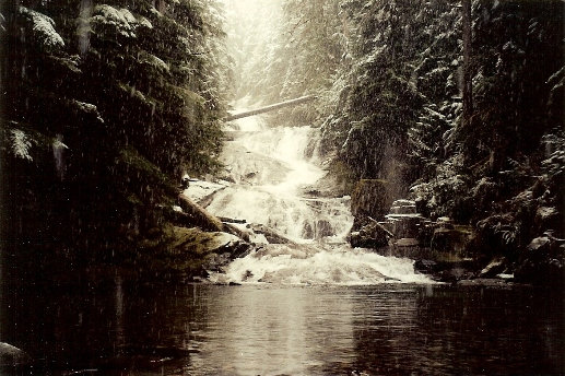
Chenuis Creek drops down a series of rocky platforms to form the multi-tiered Chenuis Falls. The water drops approximately 150 feet within 300 feet to a calm pool below. The short trail leading to the noisy cascade is perfect for families or for visiting relatives who want to experience Mount Rainier National Park without getting too far from the car. Some even swim here on those few Northwest days where it is hot. If the bridge is gone from winter floods, hike the Green Lake trail or Carbon Glacier Trail.
Chenuis Falls
Distance: 0.5 miles
Elevation Gain: 50 feet
Access Rating: Good Dirt National Park Road
Take State Route 410 to Buckley. Turn right onto SR 165. Proceed to the bridge over the Carbon River Gorge and then bear left to Mount Rainier National Park's Carbon River Entrance. Flood damage often closes the road, if closed, walk the road for 2 miles to the parking area and sign for Chenuis Falls.
Access:
The trail crosses the Carbon River on a bridge (if there) and winds through forest about � miles to the falls, which cascade down a series of rock slabs. The path continues 3 miles up the side of Tirzah Peak but does not attain any significant viewpoint. Eventually, it returns to Chenuis Creek at a point some 2 miles outside the park. You can climb Tirzah and Wallace Peaks from here but there is no trail and few views up top.
Route:


Chenuis Falls during a heavy snowfall

