Palix - AWS Observation Post
& Possible Fire Lookout (Clearwater Point & Logger Benchmark)
AWS in Washington
Palix has not been on any fire lookout list before and the background was extremely difficult to dissect. Palix was a high hill SW of Raymond, picked out by the ARMY for AWS coverage in Sect. 16, T13N, R9W. Unfortunately for the ARMY, the hill was covered with heavy timber and not that prominent. The Palix River ran along the whole north side of this location, hence the name. The State Division of Forestry (aka DNR) was working together with the ARMY to make the decision where to build the site for joint use.
A better location was picked out to the NW of Raymond and for some reason, the name Palix continued to be used even though the new site was not near the Palix River. At this new site, the structure and location was planned to be used for fire. The plan was for the State to build the structure but for it to be temporarily be utilized for AWS. The warden identified a location known as Clearwater Point. He said that if the point was satisfactory to the Army, the State would put a tent and establish a temporary point for the spring. The Division of Forestry would then make a thorough search of various points along the ridge and probably would build a permanent lookout somewhere in the general vicinity. In order to get fire detection from a point on this ridge, it was recommended that a tower of 100 feet in height to be built.
In the end, I believe the DNR settled with putting the permanent lookout at Trap Creek, about 5 miles away from the original Palix location. Trap Creek is well known and on the Washington Lookout Inventory. I can't confirm if Palix was actually used for fire. Below is a timeline to help us try to figure out what the story is with Palix.
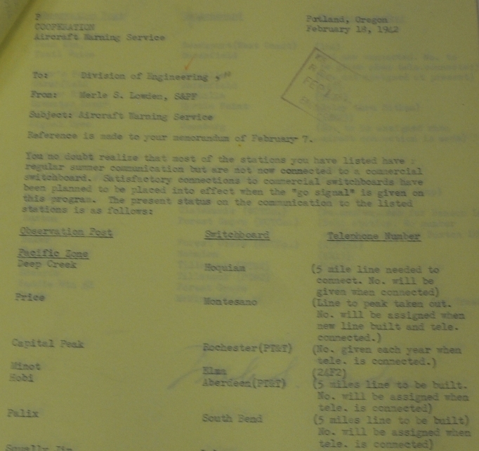
February 18, 1942 (Peliminary Switchboard Document if AWS program is activated)
Palex is listed as an observation post needing 5 miles of line to be built to South Bend.
March 19, 1942 (Document discussing where to put Palex, but both STRs have errors)
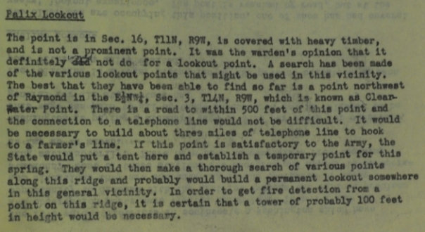
The point is in Sec. 16, T11N, R9W, is covered with heavy timber, and is not a prominent point. It was the wardenís opinion that it definitely will not do for a lookout point. A search has been made of the various lookout points that might be used in this vicinity. The best that they have been able to find so far is a point northwest of Raymond in the E1/2NW1/4, Sec. 3, T14N, R9W, which is known as Clearwater Point. There is a road to within 500 feet of this point and the connection to a telephone line would not be difficult. It would be necessary to build about three miles of telephone line to hook to a farmerís line. It this point is satisfactory to the Army, the State would put a tent here and establish a temporary point for this spring. They would then make a thorough search of various points along this ridge and probably would build a permanent lookout somewhere in this general vicinity. In order to get fire detection from a point on this ridge, it is certain that a tower of probably 100 feet in height would be necessary.
Early 1942 (Art Johnson was fire warden)
The location at Palix is temporary. Art Johnson wants a tower at a point further south and this should be done when Mt. Goodyear makes a definite decision as to the construction of the tower in this neighborhood.
July 1, 1942 (List of State Lookouts in 1942)
Station No. 36, Warden is Art Johnson, Raymond District, Name: Palix, 10 inch firefinder, elevation 1,100 feet, located in SE, NE, SW S3, T14N, R9W
July 28, 1942 (Telephone & Exchange doc showing exact location)
Dec 1, 1942 (AWS Observation Posts List showing exact location)
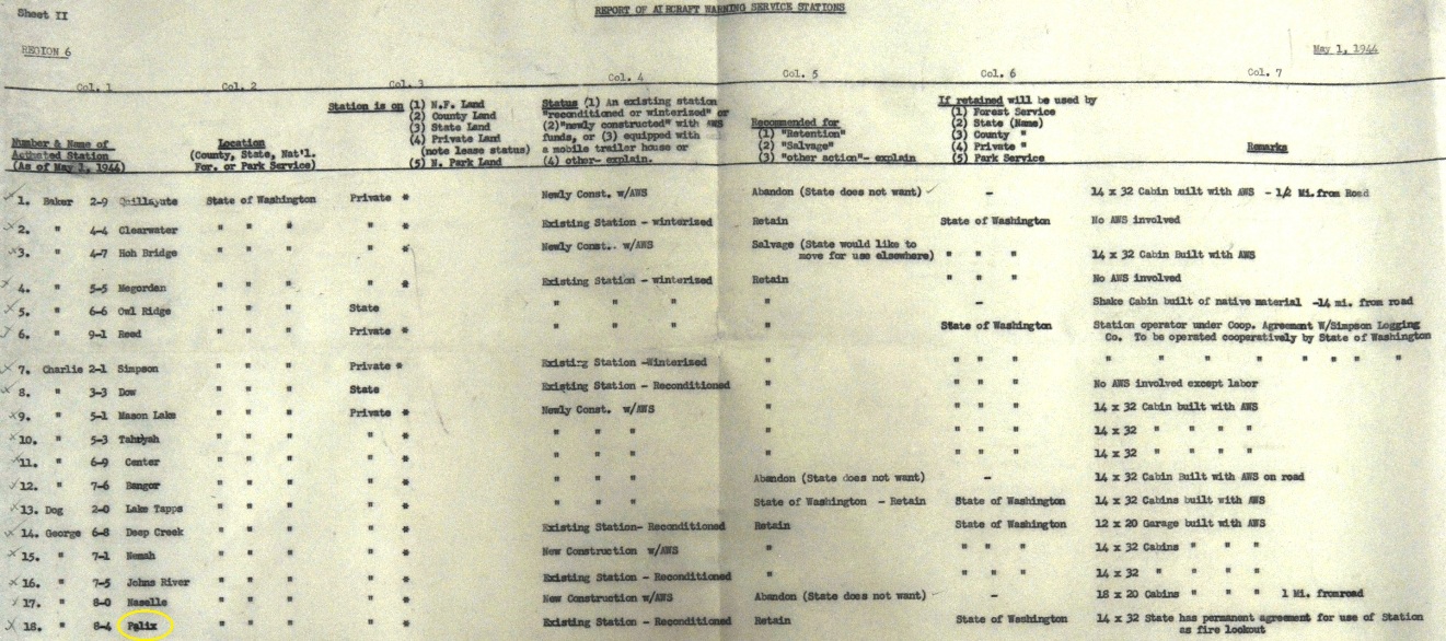
May 1, 1944 (Final report of Aircraft Warning Service Stations)
State of Washington existing station on private land Ė reconditioned, to retain for the State of Washington. 14x32: State has permanent agreement for use of station as fire lookout.
May 23, 1944 (Report of AWS Telephone Lines)
4 miles constructed, private land, from Raymond to the post, retain for State use, this will be permanent State lookout.
Elevation: 1,100 feet
Access:
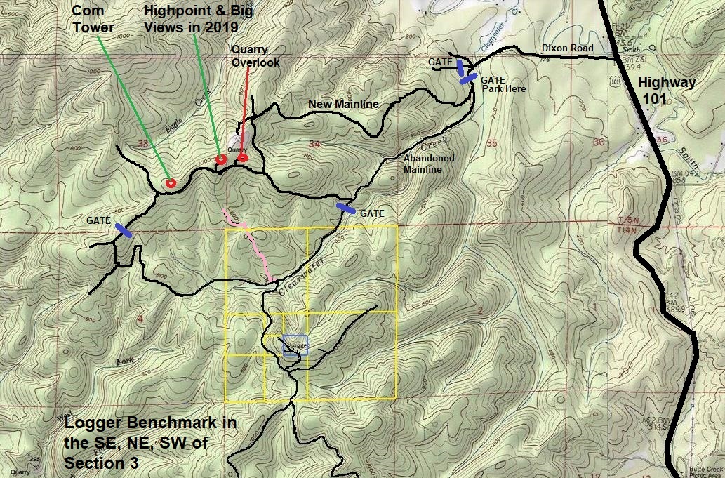
From Highway 101 north of Raymond, turn west on Dixon Road. Follow it around one mile until you cross over the Clearwater River and reach two large forestland gates. The left gate is the one you want.

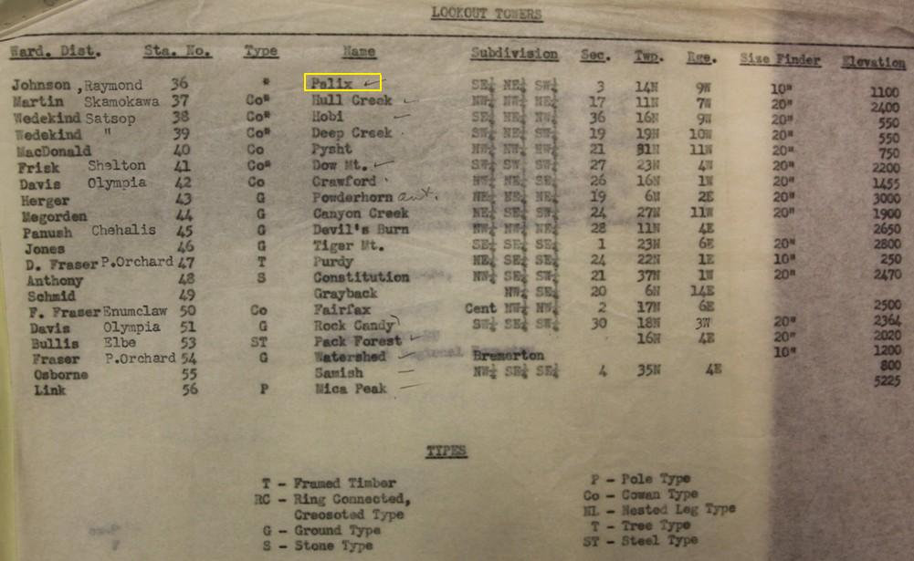
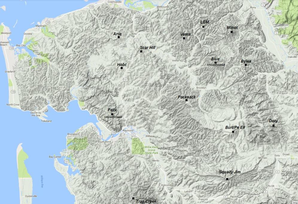
Lookout Towers List - The STR given on the list is shown on the map below.
Map showing the known fire lookout locations with a few unconfirmed as well
I believe the permanent site they ended up with was Trap Creek Lookout (based on docs from another nearby AWS station)






First line STR should have said: Point in Sect. 16, T13N, R9W is covered with heavy timber
Sixth line also got STR wrong: should have been E1/2 of the SW1/4 of Sec. 3
Route & 2019 Visit:
In 2019, the gate was Hancock Management and they were allowing foot and bike traffic. Shortly up the road past the gate is a Y intersection. The old mainline that follows Clearwater Creek is left and now abandoned due to washouts. Many fallen trees and drainages make travel slow for biking but it is a good hiking option. If biking, the new mainline goes right at the Y and climbs up to an open pit mine that would not be good during work hours. This new mainline and the old route is shown on the provided topo map. The new route will take you up and down extra elevation and miles. If your goal is views, you will stay on lands that allow access. If your goal is the Palix location, you will be trespassing on timberlands of a different ownership (Salmon and Bavarian in 2019). They have no trespass signs on 2 gates (also shown on the map). At the Palix summit, hidden in the brush is the old Logger benchmark (now gone). The summit was cut in the early 2000s so unfortunately, the views are now gone due to growing trees. The summit is fairly broad and covered in new trees so it was pretty hard to do a thorough search of the area. A recent harvest may have manipulated the summit as well. The AWS documents clearly place the lookout site on the Logger Benchmark, but based on some 1940s aerials, I also checked out the ridge to the east that had some promising locations. That ridge was broad and overgrown as well making things difficult.
Side trip for views:
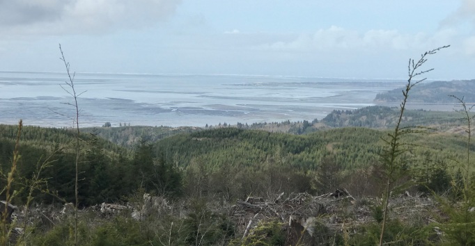
If you want a side trip and or donít want to go into the No Trespassing area, a nice highpoint was recently harvested and has a great view, probably until 2025. Use roads on map to reach this spot and it can be done as a loop if you do go past the second gates.
Palix on private land, an existing station, reconditioned, to retain for the State of Washington, 14 x 32 foot cabin State has permenent agreement for use of Station as fire lookout.
AWS observers Mr. and Mrs Gerald Kuhns
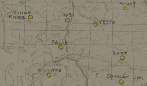
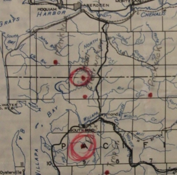
An early map used for AWS shows Palix it the original planned location south of South Bend.
It also shows the clearwater location north of Raymond where Palex was placed.
AWS map showing Palix.
Feb. 18, 1942 document as AWS was being prepaired and organized, shows Palix needing 5 miles of phone line to South Bend (this would be the original planned location).
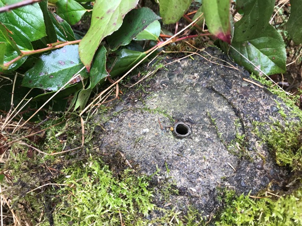
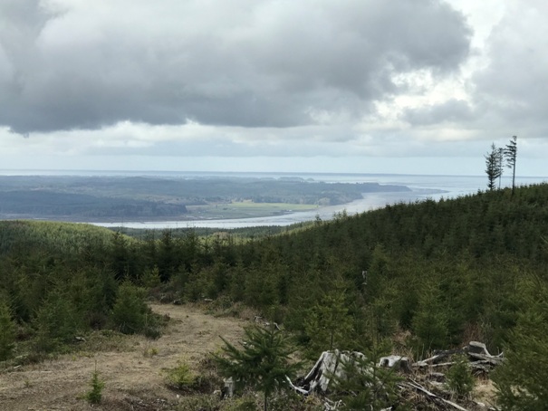
Logger Benchmark with missing disk
Looking south to the mouth of the Willapa River from the highpoint side trip
Looking West across Willapa Bay to the Pacific Ocean waves crashing on the horizon.
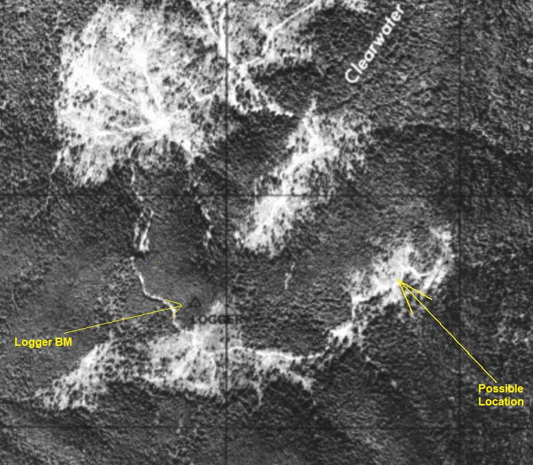
Palix location area in a 1940s aerial photograph

Looking toward the Logger Benchmark area (one of the lower bumps) from the highpoint side trip
Another document with the STR
Another document with the STR
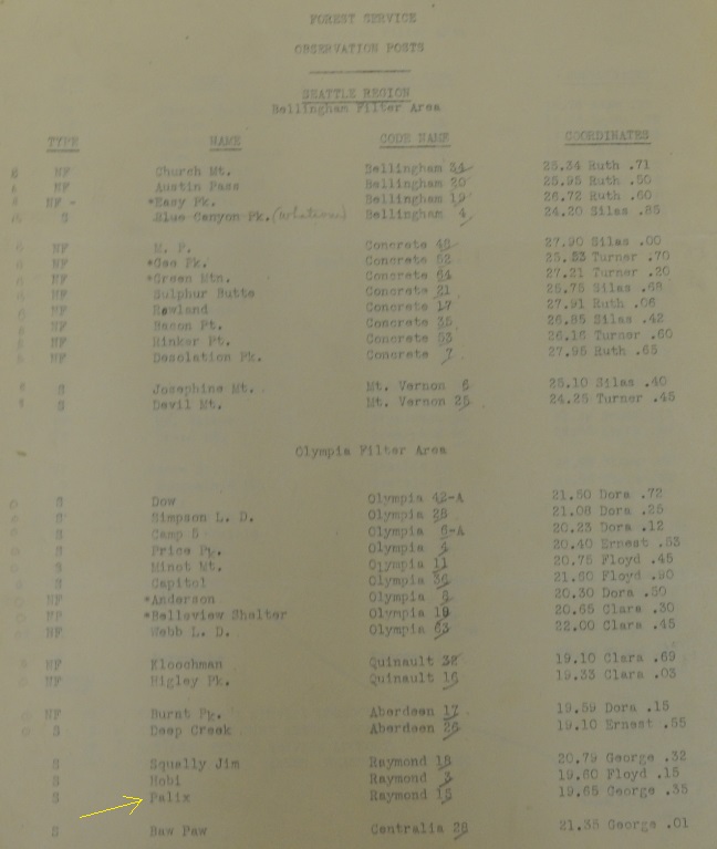
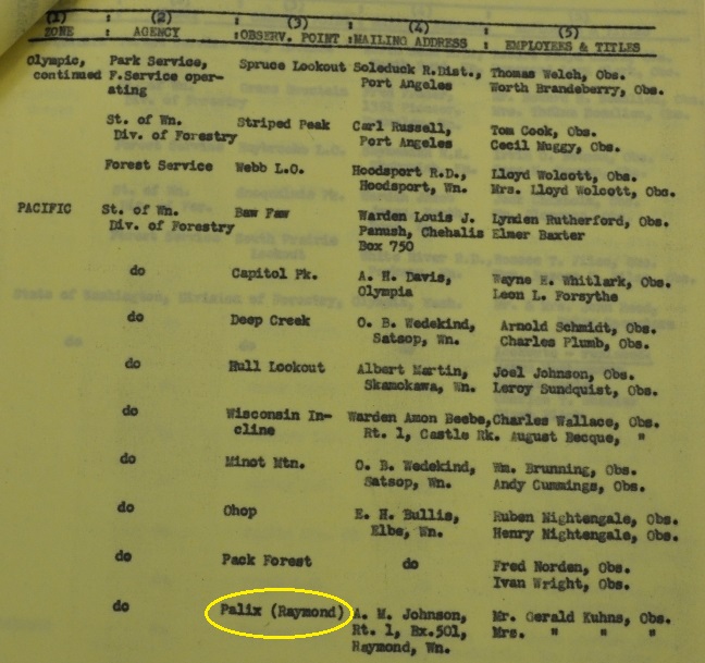
List of Observation Posts, Palix is shown as a State Forest Fire Association Lookout.
Telephone line document with Palex site cut out. Says to retain for state use. This will be permanent State L.O.
Maintenance of Existing Projects
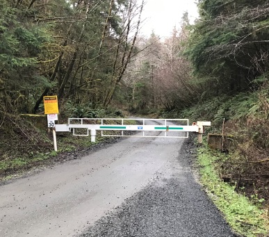
Entry gate in 2019
AWS in Washington
Map as of 2019, subject to changes as landownership changes often. Hancock owned the lands on the north half of this trip while an investment firm (aka your 401K) owned the south half.


