Badger Peak Lookout
Summit elevation: 5,664 feet
Distance: 3.5 miles
Elevation gain: 1,800 feet
Access: Very Good Gravel
This short hike might take more time driving to than on the trail. Hike in thick forests until you break out at the summit of Badger Peak.
Washington Fire Lookouts
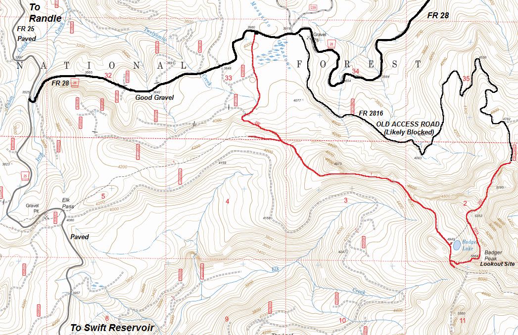
From Randle, go south out of town on State Route 131. It will become Forest Road 25. In about 20 miles you will come to the junction with Forest Road 99 which goes to Windy Ridge/St. Helens. Continue south on FR 25 for about 2 more miles and turn left onto Forest Road 28. Follow FR28 for about 2.3 miles to the Mosquito Meadows trailhead is on the right side. (The old access was to continue and bear right onto Forest Road 2816, following for 4.4 miles to a trailhead).
Access
A Chehalis newspaper said in April of 1926 "an expenditure of funds for the construction of lookout towers and telephone lines in the Rainier forest will inaugurate a new system of fire control, according to Mr. Fenby, which is expected to greatly reduce the fire loss in this section. The first tower will be constructed on Badger peak, which is on the ridge between the Lewis and Cispus rivers midway between Mt. Adams and Mt. St. Helens. This lookout will cover eastern Lewis and Skamania counties and the ranger in charge will have a 30-mile view in all directions. These lookout towers are a combination ranger cabin with a glass enclosed cupola in the top containing an instrument known as the Osborne fire finder." A structure was built (sources say 1924 or 1926 or 1928) but what and whenever it was built, it was replaced in the 1930's with a L-4 cab. This second structure was removed or destroyed in 1960. The USGS marker on top is labeled Badger LO RM 1937. Note, this is Badger Peak, don't confused with the former Badger Mountain lookout above Wenatchee.
Lookout Site
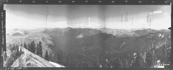
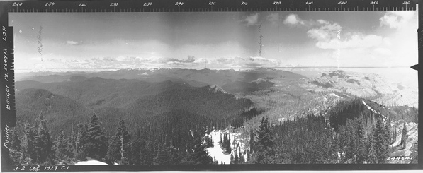
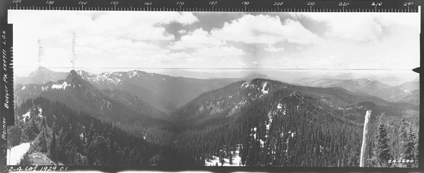
View South 1929
View Northeast 1929
View Northwest 1929
(Images removed from the web until I return on good day for better shots)
I wasn�t too excited to go peak-bagging on a rainy day so I settled on a mountain bike peak bagging trip. I should have stayed home. We started at the Mosquito Meadows Trailhead off FR28 in Gifford Pinchot with the hopes of climbing Badger Peak, Kirk Rock, Shark Rock, Craggy Peak, Hat Rock and Snagtooth Mtn. It was pouring rain and it did not stop the entire day. The day got worse when some hunters came out of the trailhead explaining that our lack of bright colored clothing was going to get us shot. One hunter explained he had to pull his finger off the trigger as he almost shot a mushroom picker the day before. (I was always taught to know what I was pointing my gun at!) Then, after about 1 mile my friends bike broke down. As we were ditching the bikes, my friend found a reflective vest in his pack. I put it on but it looked like I was wearing an orange sports bra. I walked in front from this point on. We continued on foot only to find a nice road paralleled the trail 1.3 miles into our hike. After 3 miles, we made it to Badger Lake and hiked up a trail to the summit of Badger Peak. Some old evidence of a lookout but driving rain and wind kept our visit short. Back down to the lake, then on towards Kirk Rock. Passed a lot of hunters�.nobody had seen any game all day. Everyone thought we were game wardens so people were pretty friendly. Kirk Rock was a few hundred feet above the trail taking the NW ridge in woods. We traversed around to the south side where a route was possible�maybe class 3-4. In good conditions, we would have run up the rock. Today, the force and sound of the wind slamming against the rock was too ominous. It appeared there was about a 40 foot climb, then another 40 on a summit ridge. I believe the wind would have carried me away up there. Dropping back to the trail, we continued to Shark Rock. The map gave the impression the trail goes over the summit. Not so, as the name implies, there is a spine of rock that requires rope. Arg�.I should have done some more research and brought some gear, but then�we were just out to do some mountain biking. Now completely soaked, I walked 5 miles back to the bikes, and the trailhead.
My Trip Report Nov 4th 2006 (found trip report but not my pictures)
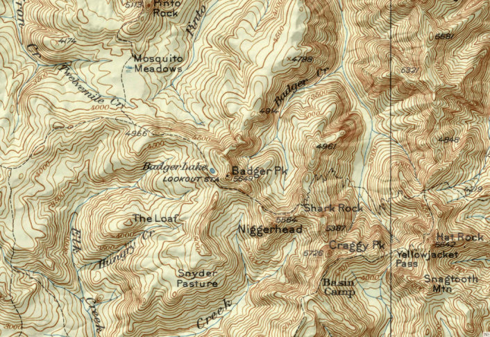
1945 Columbia National Forest Map
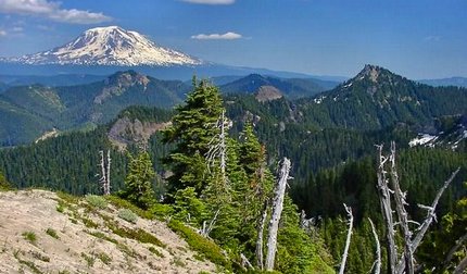
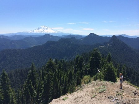
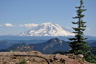
Mount Adams
Anchor Bolt
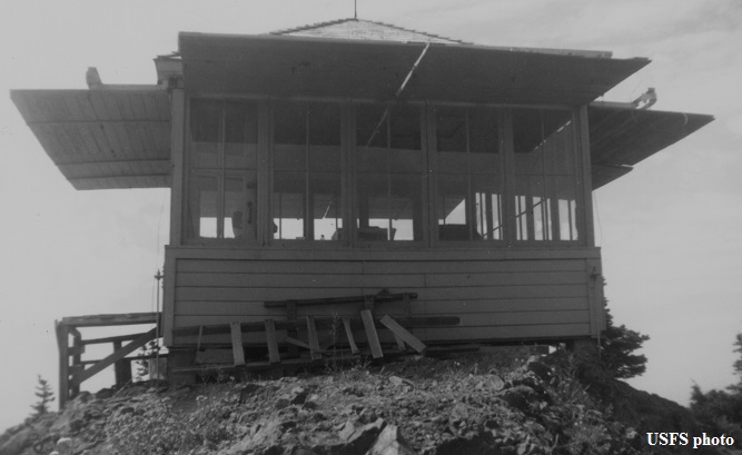
Badger Lookout 1964
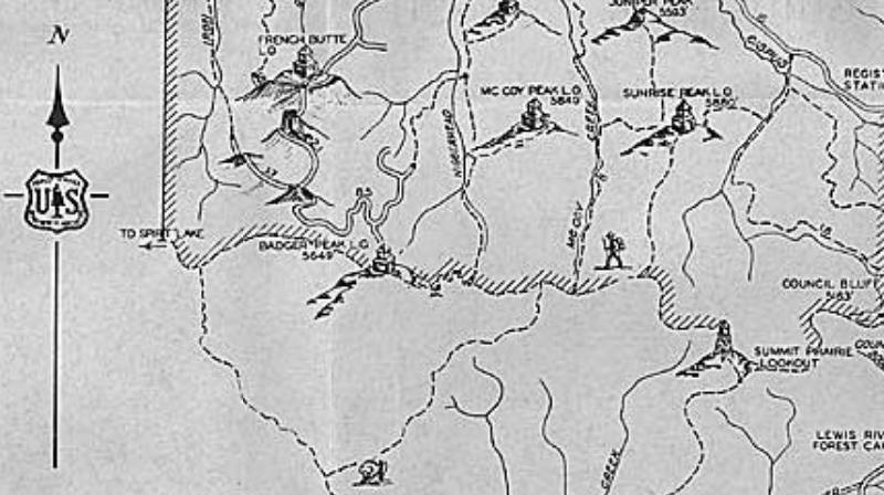
Columbia National Forest Rec Map 1937


