
Nelson Peak is the highest mountain in the Northern Oquirrh Mountains and is very prominent when viewed from the Salt Lake Valley. In Utah, it is the 117th most prominent peak with a prominence of 1699 feet. Nelson Peak is rarely climbed because all access from the eastern Salt Lake Valley side is private property. Most assume the entire mountain is off limits but from the county line which runs the top of the Oquirrh Range here, the entire western side is BLM land. Only standing on the very summit are you likely on private land. Although not shown on most topographical maps, Nelson Peak has a nice road to the summit from the east to service the communication tower on the summit. A route from the west will be cross-country and as adventurous as any peak in the western desert.
Take Interstate 80 west from Salt Lake City to the Tooele Exit #99. Go south on highway 36 until you reach Tooele. At the first intersection in Tooele with a stoplight (1280 Street), turn left. (There is a Wal-Mart and Carls Jr.) Immediately make another left (Pine Canyon Road) as it heads back north paralleling highway 36. This road soon heads east directly to the Oquirrhs. After a few miles is the small settlement of Pine Canyon (Lincoln). Turn left on Churchwood Drive, follow to the end where there is room for several cars. Between June 1st and October 31st, the gate should be open and you can drive to the base of the mountain. If conditions are good, the gate will remain open until December 5th.
Nelson Peak and "Nelson Ridge"
Distance: 6.65 miles from Churchwood Drive to summit of Nelson
Elevation Gain: Almost 5,000 feet round trip
Summit Elevation: 9,359 feet
Access: Paved
www.WillhiteWeb.com: Your online resource for hiking, climbing and travel
Access:
From this access point, Nelson Peak could be climbed from a number of routes. Taking this route up the western ridge allows you to summit a smaller neighboring peak I call "Nelson Ridge" or Peak 8100. Getting to "Nelson Ridge" is an enjoyable climb, I can't say the same for the traverse over to Nelson Peak.
From the end of the pavement and gate on Churchwood Drive, take the dirt road to the right as it heads east along a property line. Eventually it will reach a north/south powerline road. Follow it north along the powerlines until you reach another gate. Beyond is private land but no signs showed it and most wouldn't know this. Just past the gate is a road to the right entering Flood Canyon. Inside Flood Canyon, somewhere near the end of the road, you are back on BLM land. (We ditched our bikes here...a 2 mile ride from the Churchwood Drive Gate. From the area near the end of the Flood Canyon road, climb north up a drainage until gaining one of several ridges accessing the long west ridge of Nelson Peak. Reach point 7870, the far west point on the ridge to Nelson. There is some brush below this point but game trails are excellent and most of it can be avoided. After a few humps, you reach the summit of "Nelson Ridge". Beyond is a 400 foot drop, then a ridge walk that is often brushy with rocky outcrops that must be negotiated around. Maybe in summer this wouldn't be that bad but with fresh snow it was an awful snowshoe for us. The ridge between point 8497 and Nelson was open and enjoyable. The final 100 feet up Nelson is blocked by a cliff band with intermittent sections you can get climb through. Most of these are class 3, you'll want a Ice Axe/crampons in winter. But, you can traverse around the south side below the cliffs to the east side where the cliffs terminate and the terrain eases. Climbing in winter or spring before the private summit road opens would be my recommendation. Although, the summit area only has one facility that probably gets few visitors and it's a bit off the highest point. A lower ridge far below to the west holds all the TV antennas. The very summit is free from any facilities. Nelson could be climbed year round but brush and heat might make summer climbs rough. Try to pick a nice day in early spring when all the snow is consolidated and covering the brush.
Route:
Nelson Ridge
Nelson Peak
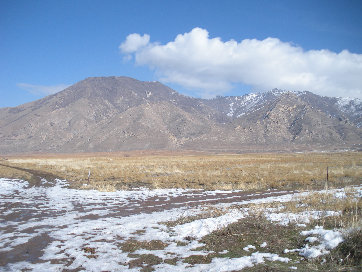
View from Highway 36 just north of Tooele


"Nelson Ridge" from the gate
Sign at the end of Churchwood Road
Morning sunlight just hitting Deseret Peak, Stansbury Range

We saw 40 deer, heard wild turkeys and coyotes and saw cougar and bobcat tracks


Gap
"Nelson Ridge" HP
Point 8497

Nelson Peak

The diving board


I-80 and Stansbury Island in distance
Looking north to Farnsworth Peak
Looking east from summit toward Wasatch Mountains
A panoramic shot showing the entire Oquirrh Range to the south
We traversed below the summit rocks to a gap on the other side of ridge
Last bit of climbing to the summit of Nelson Peak
From ridge just east of point 8497, showing rest of the route being brush free and easier going
West of the "Nelson Ridge" highpoint, route follows ridgeline to the gap then up just below point 8497
Around 6520' on ridgeline working toward "Nelson Ridge"
On Nelson Ridge working towers a false summit
Point 8497

Working up to point 8497 area