
From Highway 36, take a good gravel road west out of Vernon or the gravel Pony Express Road out of the Faust area. Both merge up before hitting Lookout Pass. Cross over the pass and drop down the hill. Just before the road levels out making a big curve to the south, a sign should point left to "Little Valley". Drive up the Little Valley Road for 0.3 miles for ATV peak. Drive up 1.6 miles for the turn to "East Little Valley Peak" and continue up almost to the pass for the road split for "West Little Valley Peak".
Little Valley is tucked away at the merging point between the Sheeprock Mountains and Onaqui Mountians. This report covers 3 highpoints for some exploring on a bad day. The area is extremely popular so go in the off season if you wanted to avoid the ATV crowds. Of the three, I strongly suggest the highest as the best peak for scenery and route, peak 6842 "Little Valley East Peak". All can be accessed by regular vehicle but a truck with high clearance will get you a bit closer to each.
Little Valley Peaks
Distance: 0.5 to 1.5 miles
Elevation Gain: 500 to 843 feet
Summit Elevation: 6,323 to 6,842 feet
Access: Most vehicles
www.WillhiteWeb.com: Your online resource for hiking, climbing and travel
Access:
Route:
For "ATV Peak", park in one of the many camping spots off Little Valley Road. There are many spurs here but most lead to the ATV/4WD road that goes most of the way up the mountain. If you have 4WD, you can make it to about 6100 feet although the rocks are sharp. From the false south summit, drop about 30 feet and climb open slopes 160 feet to the top.
For "Little Valley East Peak", a high clearance 4WD road goes much of the way. ATV tracks finish the job nearly reaching the summit. Shortly after the Little Valley road the tracks cross a creek, then climb a bit along the east end of the valley. Shortly after a steep drop to cross a drainage, there is a left turn near a big Juniper tree. This road left goes up the NW ridge. Somewhere along the way the road becomes mostly ATV tracks. Just follow it to the summit where I placed a register in a small cairn.
For "Little Valley West Peak", continue up the Little Valley Road until just before the pass. It's easy to miss the turn. If you hit the pass, turn around and it's easier to see going downhill. Park somewhere within a half mile or so. There are two summits of nearly equal height. This would be the least interesting hike of the three.


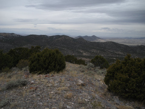
Looking south to Black Crook Peak on left with Red Pine Mountain on right
"Little Valley East Peak"


Looking north to Stookey from "ATV Peak"
ATV Peak
Looking north toward the Onaqui and Stansbury Mountains


Looking to "Little Valley West Peak" from the east
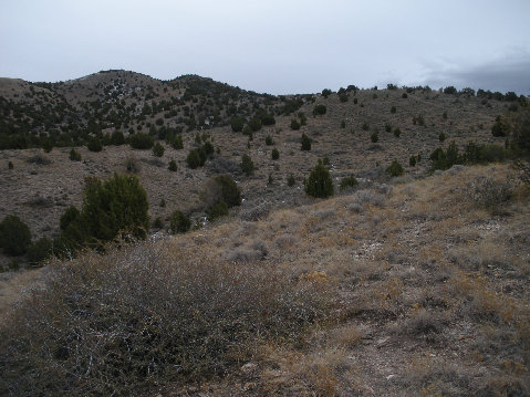
Route up "Little Valley East Peak" goes op right skyline
Looking east to Vernon area
Indian Peaks to the west from "ATV Peak"
Black Crook Peak

Black is road, blue is ATV/4WD and yellow is no trail