
This is an interesting loop hike on trails used more by cows than people. Along the way are 3 highpoints but a loop could be done just grabbing the highest and best summit, Bald Mountain. I would expect this trip to be best in spring or late fall when snow covers the higher elevations but a wet spring kept the hike green into late June when I was there.
Take the Tooele exit off I-80, go south on Hwy 36 for 3 miles. Turn right on SR 138. Follow for 11 miles to Grantsville. Take a left on West Street at the far end of town. Drive 6.4 miles south on West street which becomes Mormon Trail Road. Sign given for Box Elder Canyon. Follow dirt road for 4.7 miles to trailhead. Lefts at major turns, high clearance needed for rocks in places.
Stansbury Box Elder Canyon Loop
Distance: 10+ mile loop
Elevation Gain: 3,700+ feet
Summit Elevations: 9,203, 7,701 & 7,681 feet
Access rating: High Clearance needed
www.WillhiteWeb.com: Your online resource for hiking, climbing and travel
Access
The little forest service hiker/horse sign is just after a Y in the road (turn left). The Abbots Fork trail is well defined. I ran into cows, they did not like me, so I left the trail and went up the ridge of peak 7701 or "Abbots Peak". Brush was minimal. From there, the route over to Little Bald Mountain was a nice stroll. These two peaks make a great easy outing and shouldn't be combined with Bald Mountain. There is much better access it seems to get Bald from the west in Bear Canyon. If you want some adventure, continue on as shown on the map. The trail shown on USGS maps did exist at one time but not exactly where shown. In places, the tread was excellent but you couldn't walk it because the trees and brush had taken over. The long route to Bald Mountain had some interesting spots like cow trails in the forest at 8000 feet. There were dozens of them zigzagging the forested slope. I also ran into the base of an old cabin/shelter at 8300 feet. On top of Bald Mountain is a great spot, worth the effort but not wanting to return the way I came, I dropped down the north ridge to the Box Elder Pass area. There I found a nice motorcycle trail heading north. It took me to the head of White Pine Fork where I prayed the trail existed back to Box Elder Canyon. It was faint in places but it took me back to the road, 1/2 mile below where I parked.
Route:


Below: Route took up "Abbots Fork" and back via White Pine Fork (Blue is trail, yellow is off trail)
From Bald Mountain: Peak 8855 on left, Vickory Mountain on the right
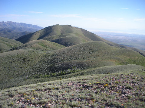
From "Abbots Peak" looking south to peak 8855, Little Bald Mountain and Bald Mountain
Little Bald Mountain
Peak 8855
Bald Mountain
North ridge of Bald Mountain
Motorcycle Trail
Deseret Peak from Bald Mountain
Onaqui Benchmark and the Great Salt Lake from Bald Mountain
On the ridge, working north to Bald Mountain summit
"Abbots Peak" from Little Bald Mountain
Route to Little Bald Mountain from "Abbots"
Final walk up Little Bald Mountain
West South Mountain & Oquirrh Mountains from Abbots
Onaqui Benchmark from "Abbots"
Hiking the ridge to "Abbots"
Bald Mountain from "Abbots"