Mount Thielsen
Summit Elevation: 9,182 feet
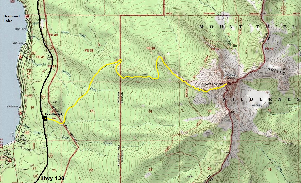
Hiking Distance: 5 miles
Elevation Gain: 3,800 feet
Access: Paved Road
The erosion-resistant plug of Thielsen is all that is left of a distant mountain that has eroded away. Mount Thielsen is known as the lightning rod of the Cascades because the summit horn is struck by lightning more than any other Cascade Peak. The summit area is easily accessible from several hiking trails in the area and has a popular climbing route.
The Mount Thielsen Trailhead is well signed and next to Highway 138, next to Diamond Lake, not far north of Crater Lake National Park.
Hike up the easy trail for 3 miles to the PCT crossing. Cross the PCT and the trail climbs the West Ridge of Thielen to the base of the summit horn. You might have to use your hands in a few places on the upper West Ridge but overall, it is a trail to the summit horn. One pitch of exposed, solid rock reaches the summit. The distance is around 75 feet from saddle to summit.
Access:
Route:

WillhiteWeb.com
Mount Thielsen from the east at Bald Mountain Lookout

Summitpost image


Summitpost image
Trailhead had sunshine when we got back
Snowline
About the area of the PCT crossing
On the lower West Ridge
Route going up the West Ridge
Just below the notch
The notch
Climbing the final 70 foot rock climb
Climbing the final 70 foot rock climb
Summit shot with no views
Using a rope seemed wise on wet snow covered rocks

Summitpost image


