
Nester Peak Lookout Site
WillhiteWeb.com
In July, 1957, George Hendryx with a State cat started work on Nestor's Peak, opening logging roads and building a road to the top of the peak for a proposed lookout site.
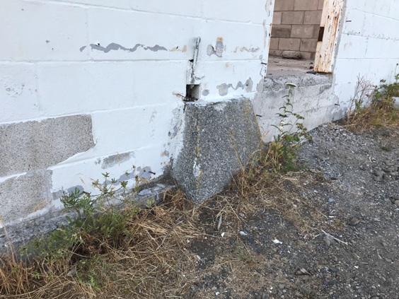
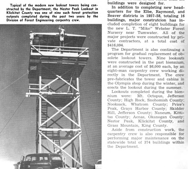
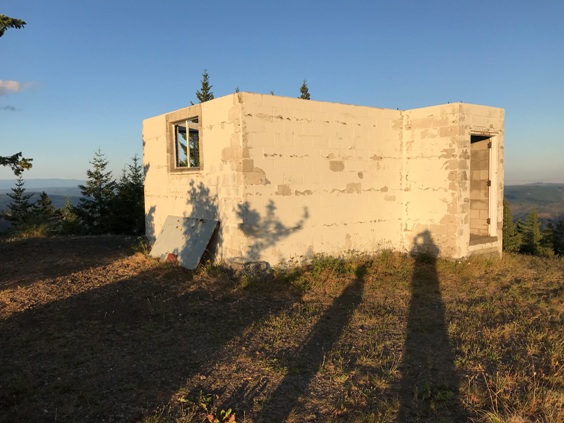
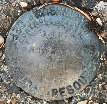
The following year in 1958, the Nester Peak Lookout was a 40 foot wooden tower with a DNR cab on top. In 1977, the tower was replaced by two-story lookout building with a concrete base. It was removed or destroyed in 1995.
Pat Neal and story told in the columbian.com
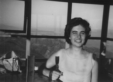
It was the spring of 1960, and I was about to graduate from high school and go to college. I needed a summer job to help pay for college, so I applied with the Washington Department of Natural Resources, Glenwood District, to man a fire lookout. I got a letter back saying that they had already hired all they needed for the summer. I was disappointed, thinking that was the end of it. Then one day, I got a phone call from the Glenwood DNR supervisor asking if I was still available for the lookout job. The woman they had hired for Nestor Peak near Husum decided she wasn’t cut out for the lifestyle of limited luxuries and loneliness. An old friend of our family worked for the DNR and highly recommended me. I said yes, I was still available, and I started an unusual job.
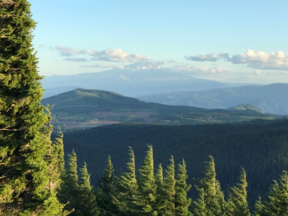
Our family friend, Rip Graham, took me up to Nestor Peak in his fire rig with my groceries and clothes. The elevation of Nestor Peak is 3,100 feet and the lookout was a 30 foot tower, with three sets of stairs going up to a catwalk that surrounded the living and observation room. There were windows all around the building — without curtains, because my main task was observing the area for any signs of a forest fire. What an area to observe. I had a view of Hood River across the Columbia River in front of Mt. Hood, the Gilmer and Buck Creek areas and much wooded area toward Trout Lake and White Salmon.
The room I lived in consisted of a table, a wooden bed with mattress, a gas cooking stove and counter space with cupboards underneath. There was no electricity or running water, which also meant no refrigeration. Water for cooking and washing was brought up to the bottom of the lookout tower in 10-gallon cans, and I then transferred the water to a five gallon can and hauled it up by rope and pulley to my catwalk.
In the middle of the room was a wooden stand with the fire finder on top and the two-way radio in the center. A fire finder is a kind of scope with a map in the middle. You point it at the smoke and get a township and range reading so that they know where the fire is located.
I was instructed on how to use the stove, fire finder and radio. I had to learn how to communicate on the radio, because another very important part of my job was relaying messages from workers in the field to HQ or to other workers. We were not supposed to use the radio for anything but business, logging all the conversations that we had on it. They told me that my outhouse was down the hill a few feet and that I had to sign in and out anytime I left the lookout and when I went to bed.
Then they left me alone. I was scared to death — what a responsibility. Since it had just been raining hard and there had been lightning, I was sure there would be smoke coming up everywhere — and there was. I called it in, and had a ranger looking everywhere for what turned out to be steam clouds rising. I finally relaxed and spent two summers on that lookout with many interesting experiences.
The wind blew so hard that it shook my tower. I got used to it, but when I had guests stay nights with me, they were really glad to leave, as they were sure the tower would blow down. One good thing about that wind was that it kept the flying ants away; otherwise they would swarm my tower and then I couldn’t open windows, so the only air I could get was from a vent in the floor. The only other living creatures I had were a family of mice that made a nest out of the toilet paper in my outhouse and had babies. There was one dead bobcat, dragged up my stairs by two young guys who wanted to show me their kill, and a dead rat I found in my water can one morning.
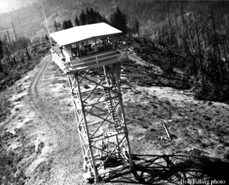
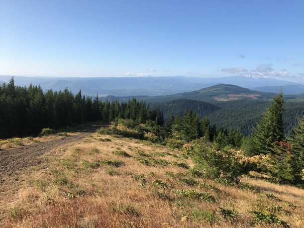
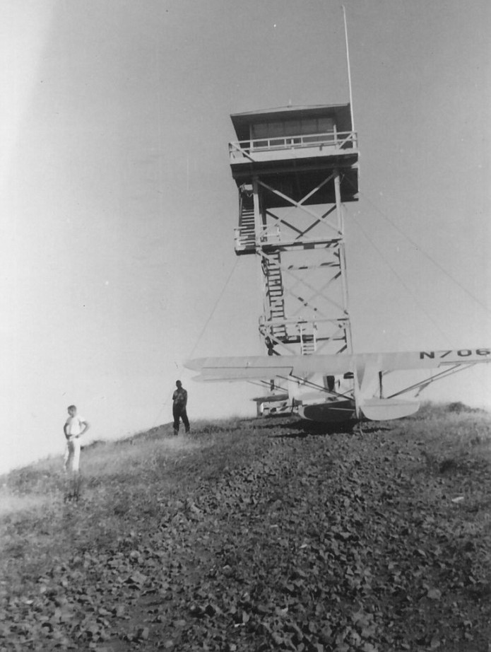
There was a road right up to my lookout, so I would have visitors hardy enough to come up a logging road. The DNR decided it needed a quick way to get me out of there in case I was surrounded with fire, so they made the road passable for a small plane to land right on it and taxi uphill. A wise idea too, as a fire broke out in the Goldendale area and it grew to over 4,500 acres and surrounded a lookout there. I knew the girl on that lookout, and could hear by radio that she was still there, transferring messages, and one was, “Get a (fire) pumper over here!” They finally got it under control, but that was the risk we took when we worked on fire lookouts.
The experiences that stand out most in my mind after all these years are standing on an insulated stool and singing hymns because lightning was striking all around me, and watching the fireworks on the Fourth of July across the Columbia in Hood River. This is just a taste of life on a fire lookout in the 1960s, and an experience I have enjoyed retelling.
Elevation: 3,088 feet
Hiking Distance: Drive-up
Agency: Washington Dept. of Natural Resources
Access: Most cars should make it with effort
Access:
There are 2 main routes to Nestor Peak, one from the West near Willard and one from the Southeast near White Salmon. For the Willard route, just east of town on Willard Road, cross a bridge over the Little White Salmon River and find a forest road going uphill on the left. Follow this road up past Little Baldy Peak and over to Nestor. Use map provided.
One of the daring landings by bush pilot Bob Edling’s coffee stops along his air patrol route.
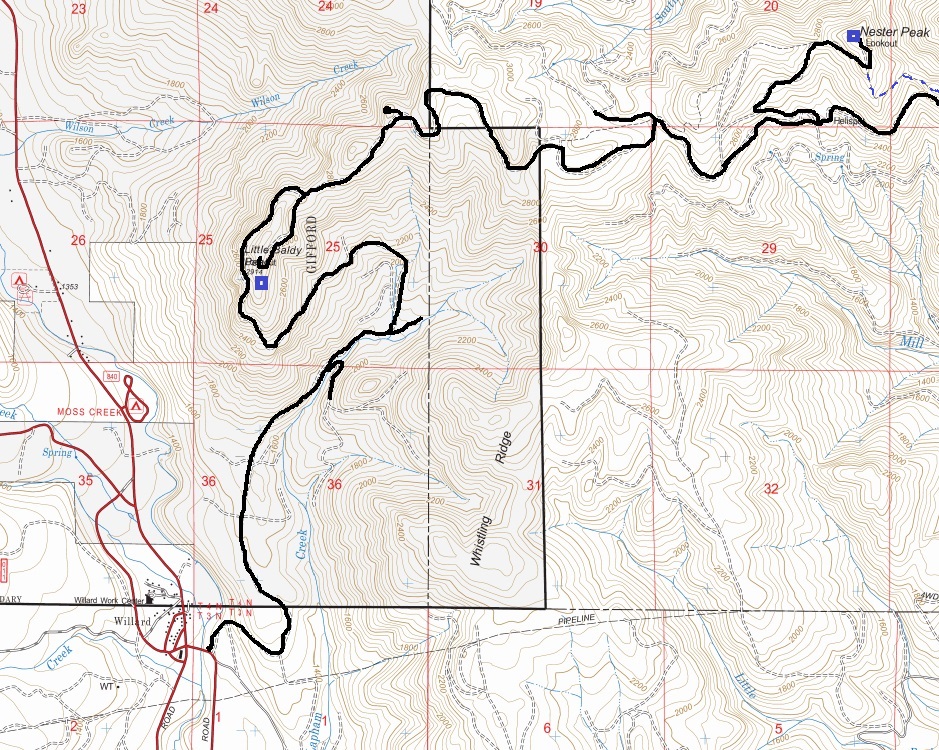
Showing route from Willard

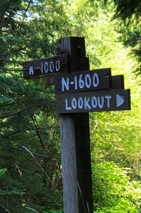
The final spur road still has a sign saying lookout in 2019.
Lookout Pat Neal
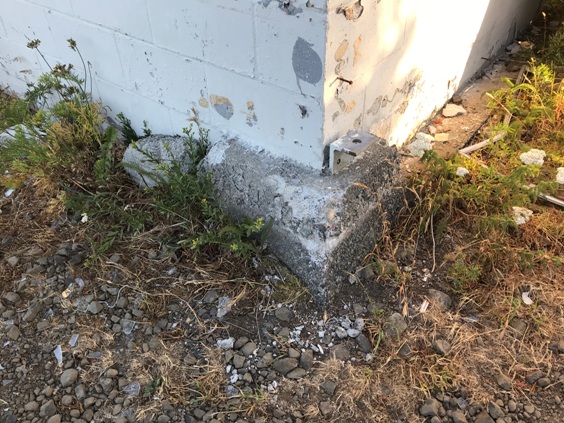
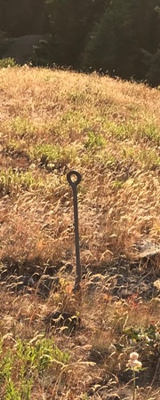
Lone anchor eye bolt
Nestor Peak Lookout 1960
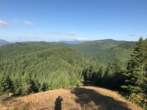
Looking West
Second lookout structure built right on top of the footings of the first
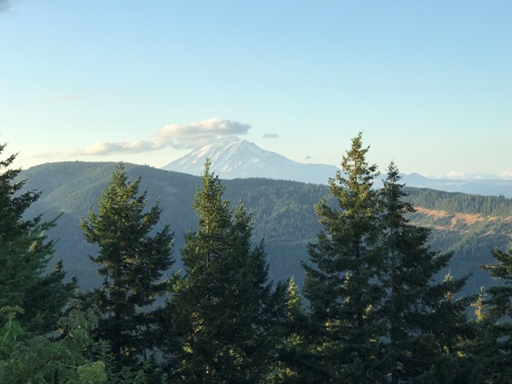
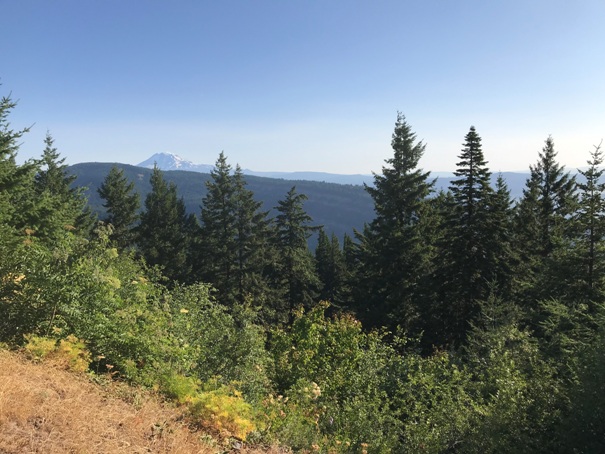
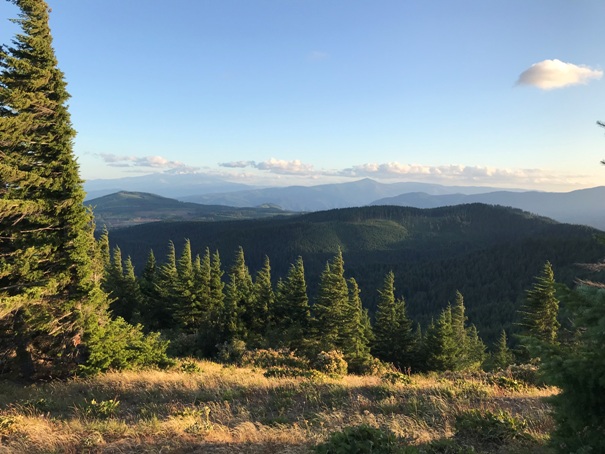
View north toward Mt. Adams
Mt. Adams
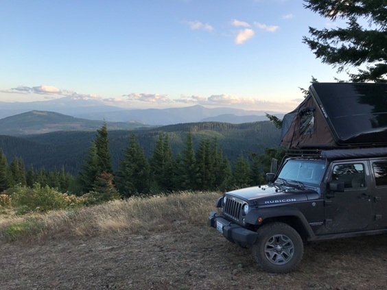
Looking South with Mt. Hood in distance (road also the landing strip)
Mt. Hood
Lower level of the second lookout structure
Camping on top of Nester Peak
Hood River, Oregon


