Oil City AWS Site & Hoh Benchmark
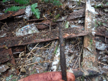
Located on the coast, the Oil City observation post location wasn't easy to decide. Early memos suggest the site was difficult to pick, and the best locations would require building trail over difficult terrain. One considered location was a high point near Hoh Head, but in the end, the Hoh Benchmark a bit to the east of Hoh Head was picked. Still, this location required a 3.5 mile trail. The AWS cabin was not on the highest point at the Hoh Benchmark but a bit further down the west ridge on a high knoll of the ridgeline. The cabin is now gone, but some remnants remain buried under years of leafs, sticks and needles. The cabin stood for many years, remnants found suggest it was used as a hangout in the 1980's, likely by oil city residents who live in isolated land parcels not too far down the mountainside. The cabin was even covered with a large plastic sheet to keep water out at some point in recent past. But today, it is so rotted and decomposed, it was un-noticeable the first time we walked right next to it. A bit of digging around revealed boards, nails, hinges and glass. In 2017, the property is on Fruit Growers Supply Company. The knob was once clear of trees in the 1940s, but when the ridge was harvested (probably in the early 80s), the new trees around the knob were not large enough to cut. So now the knob has 70 year old trees while the surrounding area is around 30 year old trees. The exact site of the structure has no trees and is distinctly open without conifer trees.
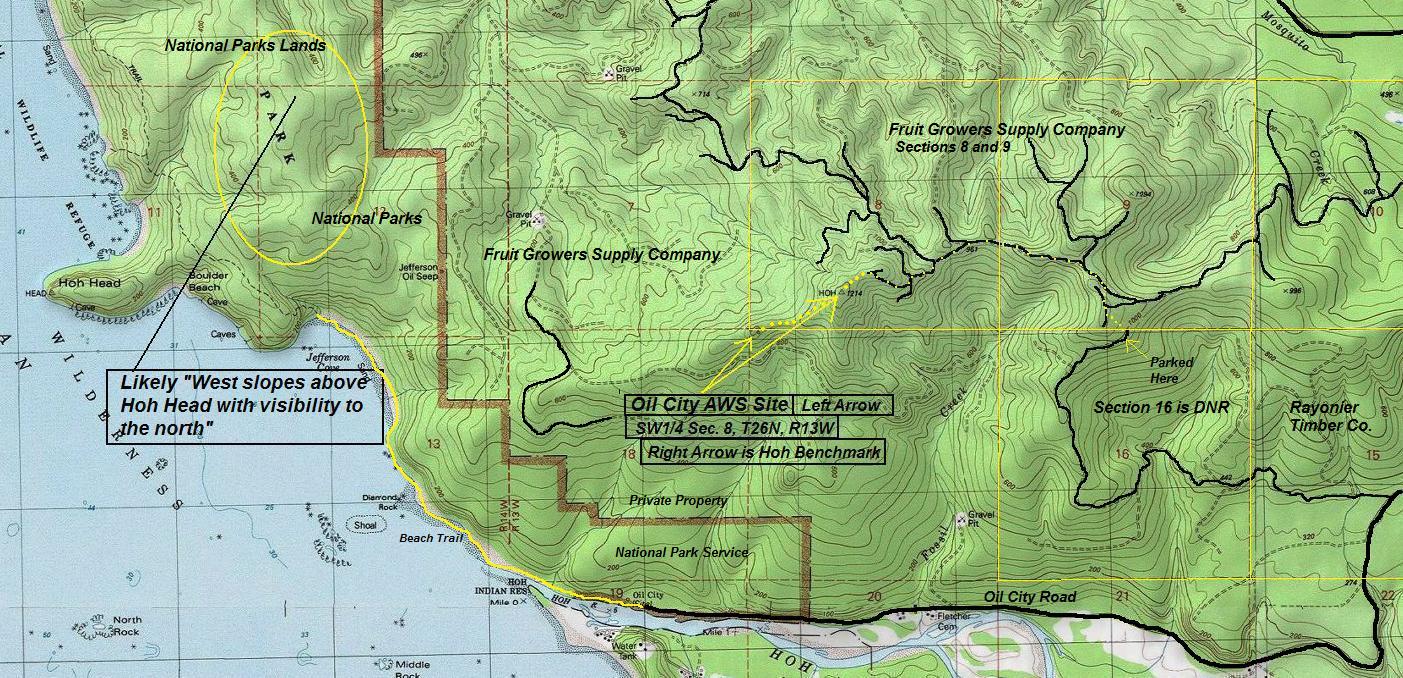
Location: SW1/4 Sec. 8, T26N, R13W
Ownership at time: National Parks Lands (says aws docs)
Elevation: 1,000 feet
Distance: Maybe 2 miles or so via DNR section 16 route
Aircraft Warning Service - Washington State
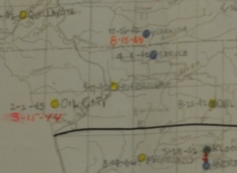
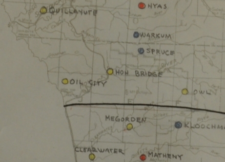
AWS map
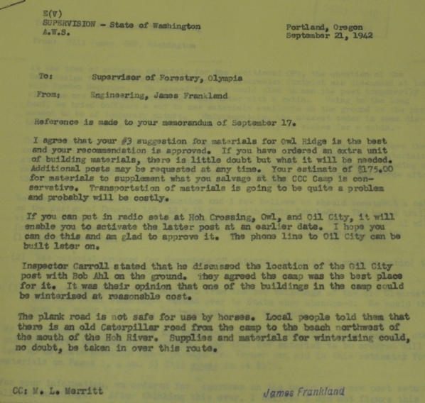
Memo: Inspector Carroll stated that he discussed the location of the Oil City post with Bob Ahl on the ground. They agreed the camp was the best place for it. It was their opinion that one of the buildings in the camp could be winterized at reasonable cost.
Sept. 21, 1942
Timeline
Memo: With reference to the report on Oil City which raised doubts in my mind as to whether we had the right location, I am sending a man down there to look for a point on the west slopes above Hoh Head where we will get visibility to the north to close the gap that way. I am also asking him to see that the triangulation point in Sec 12, "Hoh", actually is like on the ground as this has a chance of doing the trick. It looks like a tough trail show with consequently tough supplying but that applies to anything near Hoh Head also. I will advise you later as to results.
Sept 29, 1942
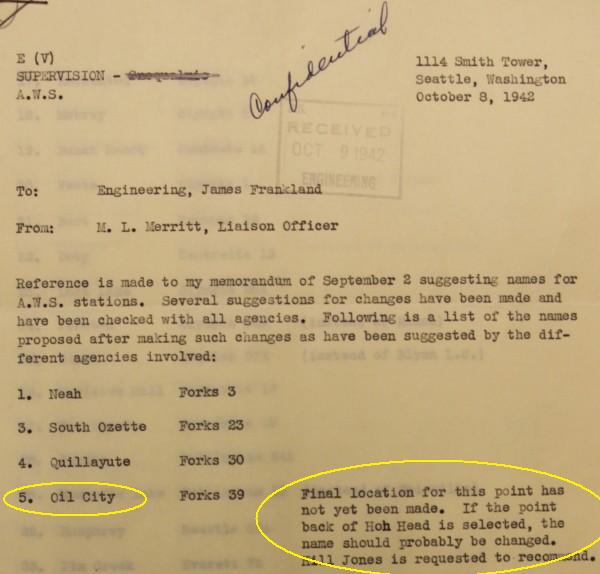
Memo: Final location for this point has not yet been made. If the point back of Hoh Head is selected, the name should probably be changed.
Oct 8, 1942
Memo: The trail has been completed to the Oil City site and some material has been packed in. We are planning to make this cabin out of a combination of sawn material and material secured in or near the site. We hope to have it in operation in three weeks.
Late 1942
Observation Posts List: Oil City. Forks 39. SW1/4 Sec. 8, T26N, R13W (This is at or near the Hoh Benchmark, mystery dot also works)
Dec. 1, 1942
List of AWS sites: Oil City on Park Service Land, newly constructed shake building, plans to abandon in place, date inactivated 3/20/1944. Station 3.5 miles from road. 12x36 shake building not worth moving or salvaging.
1944
Date shown on main AWS map as Oil City post activation date.
Feb 2, 1943
Date shown on master map as Oil City post in-activation date.
March 15, 1944
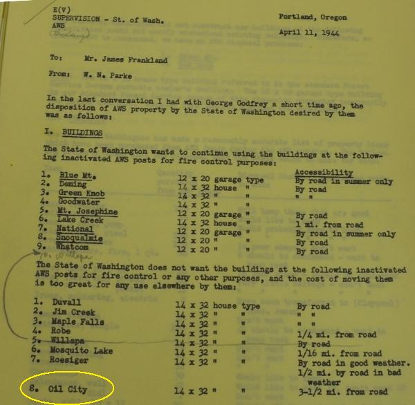
Memo: The State of Washington does not want the building at the inactivated AWS posts for fire control or any other purposes, and the cost of moving it is too great for ay use elsewhere. 14x32 house type, 3.5 miles from road.
April 11, 1944
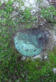
The Hoh BM summit was monumented by the Coast and Geodetic Survey in 1913. The eccentric station was made by building a platform and instrument stand in the top of a large spruce tree and falling two trees against it for braces. It was 119 feet high. Access in 1913 was via the Oil Well Trail which started a half mile from the mouth of the Hoh River (shown on maps at the time). This trail was "put in good condition" in August 1913. They followed the trail about 2 miles to the township line, then followed the line north for 200 meters, then followed a blazed trail leading to the station for 2 miles. Horses could be taken to the station. In 1954 the station was checked by the timber company Rayonier and described as firmly set and in good condition as described in 1914. Giving an overview of the route, they used the term lookout and building, saying, "turn right onto the trail to the lookout. This trail becomes very brushy near the lookout. At the lookout go to the left of the building and follow the blazed trail along the ridge to the station." The 1954 crew also explained the route in more detail....cross bridge and continue straight ahead for 2.35 miles to the Fletcher Ranch. Continue west on bladed road for 0.8 miles to a bladed road right. Turn right and drive up steep road to summit of ridge, thence north along ridge for 1 mile to end of road. Pack north along old plank road for about 15 minutes to a steep trail to the right. Turn right and pack east on trail for about 45 minutes to a cabin which is situated on a high cleared knoll. Pass around the left side of cabin and continue east along dim trail for about 45 minutes to the highest part of ridge and station.
Historic Visits to the Hoh Benchmark

1974 map showing Oil Well Road and steep road up to the square dot west of Hoh BM.
1939 Map showing Oil Well Road out of Oil City and Fletcher Ranch on Fossil Creek
1957 map showing Oil Well Road and steep road up to a dot on the west ridge of Hoh BM.



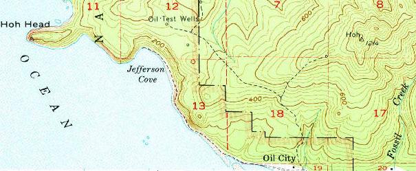
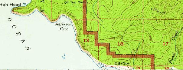
Map shows the two areas discussed for the AWS site (note the unknown small dot on the west ridge is still shown on this topo, as it was also on the 1957 and 1974 maps below).
Above and Below: 2 AWS Observation Post lists showing the Oil City OP 12/1/1942
Baker 3-7, Oil City, State of Washington, Park Service Land, Newly Constructed, Shake Building, Abandon in Place, Date Inactivated 3/20/1944, Station 3.5 miles from road. 12x36 cabin not worth moving or salvage.
AWS map with activation and inactivation dates
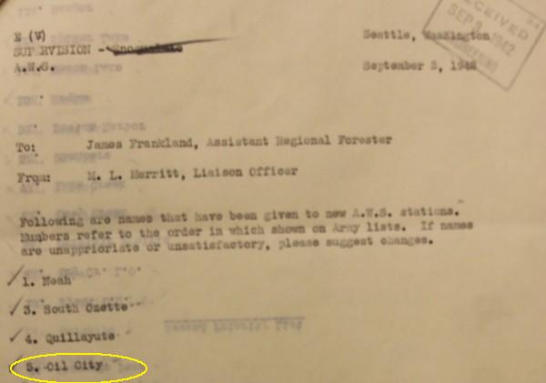
Memo naming the observation post
Construction and materials
Trying to locate a spot with good viewing (Hoh Tri-Station in Sec. 12 was in error, it is in Sec. 8, see metsker map below)
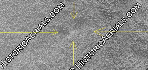
This 1952 aerial photo shows a white dot in the exact spot as the dot on USGS maps from the 1950s to today.
"Turn right and pack east on trail for about 45 minutes to a cabin which is situated on a high cleared knoll. Pass around the left side of cabin and continue east along dim trail for about 45 minutes to the highest part of ridge and station". (1954 RT party)
"turn right onto the trail to the lookout. This trail becomes very brushy near the lookout. At the lookout go to the left of the building and follow the blazed trail along the ridge to the station." (1954 RT party)
Disposition of AWS property by the State of Washington - 14 x 32 house type 3.5 miles from road. State does not want the building for fire control or any other purposes, and the cost of moving is too great for any use elsewhere.
Discussing location
Discussing location
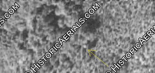
This 1994 aerial photo still shows a square object in the spot of the dot on USGS maps.
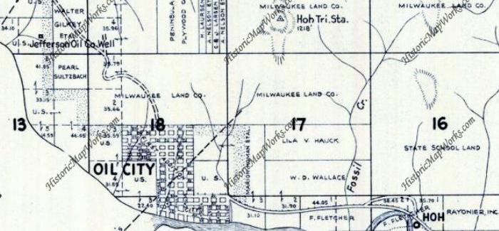
Oil City in 1952 - showing the Hoh Triangulation Station


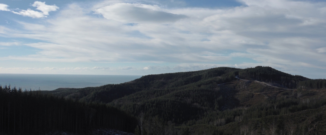

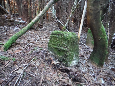
Taken in route to Hoh Benchmark. The AWS site is on the other side close to the ocean.
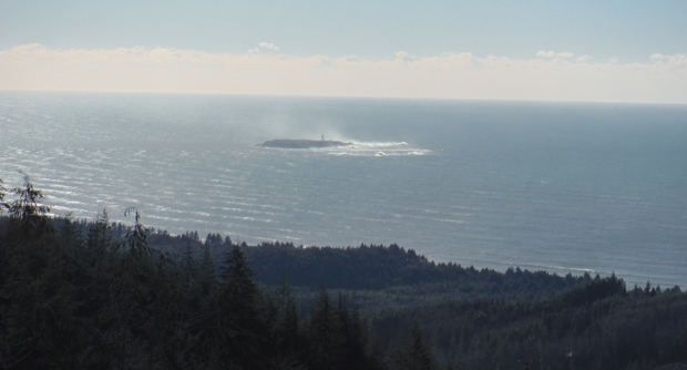
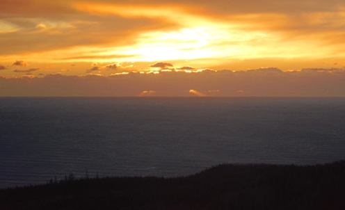
Destruction Island on a very cold and windy day
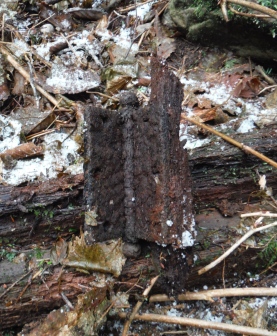
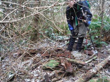
At the Oil City site January 1st, 2017
Hinge
1913 Hoh Benchmark
1913 Hoh Benchmark
2017 Visit to Hoh Benchmark
Historic access through Oil City is now private property but you could hike out to the beach, then bushwhack through the National Park to the timber company roads in section 18. We used a un-gated road (see map) that accesses public DNR lands. Other access points are via gated Rayonier Timber roads that require permits. Our route started with a short off-trail route from DNR to FGS land. FGS (Fruit Growers Supply) typically allows non-motorized access to their land.

This location was considered just off the Oil City Road
Bottles
Nail and boards
Hiking out at sunset
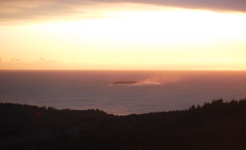
Destruction Island at sunset
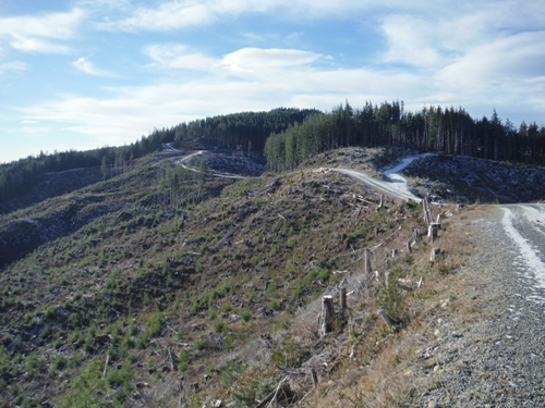
Hiking the road to the Hoh Benchmark
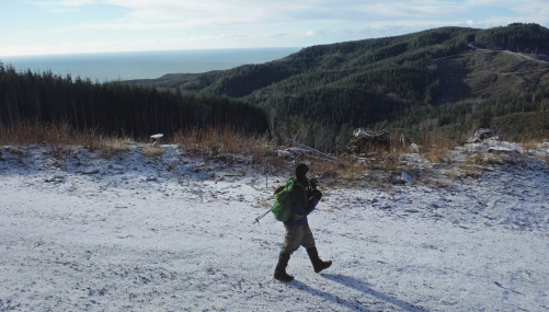
Hiking with the Pacific Ocean and our summit Hoh Benchmark in view

Looking north during road hike
(Almost 800 feet of prominence)


