Bald AWS Observation Post - (Ozette Beach)
Located on the beach near Lake Ozette, the Army managed an AWS site called Bald. Usually, the Coast Guard patrols were handling the coast but this outpost was being directed by the Army/Forestry AWS team. It was a difficult site to access requiring a 6 mile boat ride or hiking 6 miles by trail. With difficulty in 1942, a cabin was made of native materials. The cabin had 2 stoves and reported to have stood for many years. In the early 80s, there was still a cable handrail and steps cut out of the rock leading to where the cabin had been. Erosion has collapsed much of the cabin site. A list of inactivated AWS posts show the site was not a regular fire lookout. The site was not wanted by the State and it was turned over to the Coast Guard on October 1, 1943. Below is some history from AWS documents.
Location: In or near Sec 20 T29N R15W
Ownership at time: Government
Elevation: 100 feet
Date AWS was activated: May 20, 1943
Aircraft Warning Service - Washington State
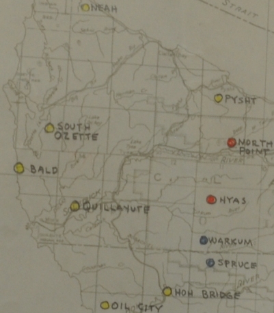
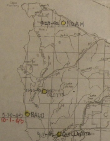
AWS map showing Bald post
AWS map showing Bald activation and in-activation date
Unknown date:
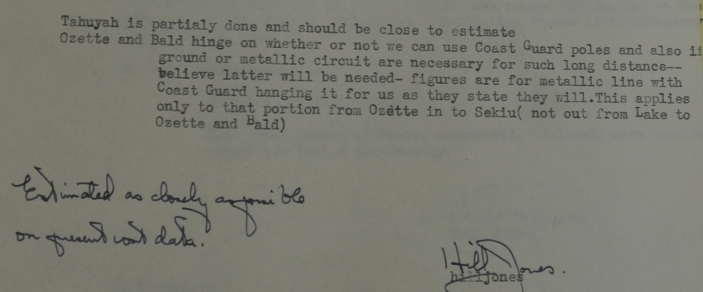
Due to a shortage in manpower we have not yet started on Bald. District Warden Russell is now outlining plans to handle a tough job of getting supplies and materials to the site and a trail and telephone line from Ozette thought blowdown country to the site. I hope to report better progress on this point, which is the only one we have not started to develop.
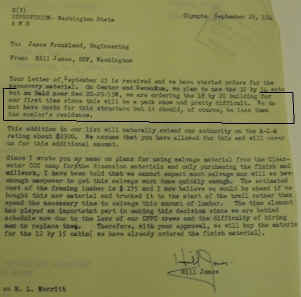
September 29, 1942
On Bald near Sec 20-29-15W, we are ordering the 18 by 20 building for our first time since this will be a pack show and pretty difficult. We do not have costs for this structure but it should, of course be less then the scalers residence.
Other
This is likely the location of the story told in Ray Kreseks book "Fire Lookouts of the Northwest" about his father getting shot at by patrol planes on the beach while bringing new radio batteries to the site. (pg. 112)
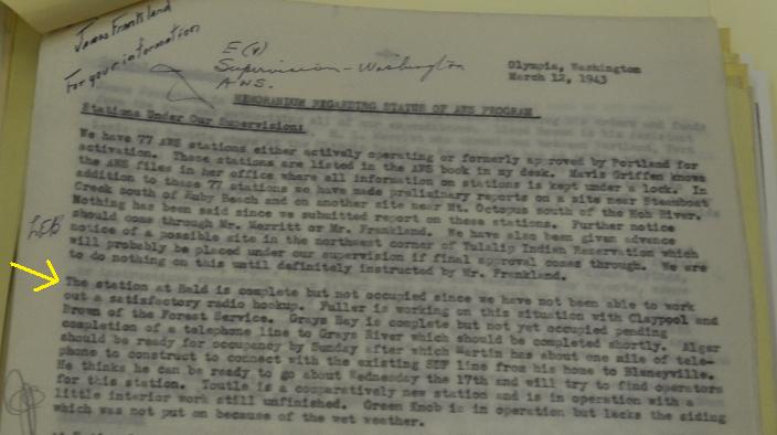
March 12, 1943
The station at Bald is complete but not occupied since we have not been able to workout a satisfactory radio hookup. Fuller is working on this situation with Claypool and Brown of the Forest Service.



Not A Regular Fire Lookout, Accissible by 6 mile boat or 6 mile by trail, building type is native materials, turned over to the Coast Guard, 2 stoves, State does not want.
Phone access issues
Complete by March 12, 1943 but not occupied
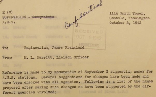
Bald to be called Forks 23A
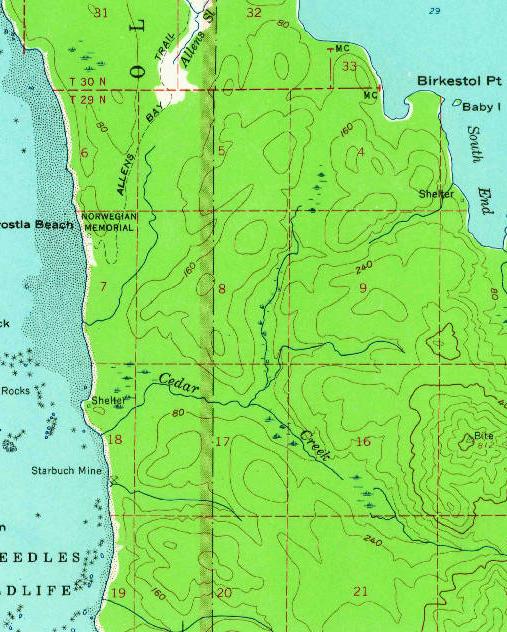
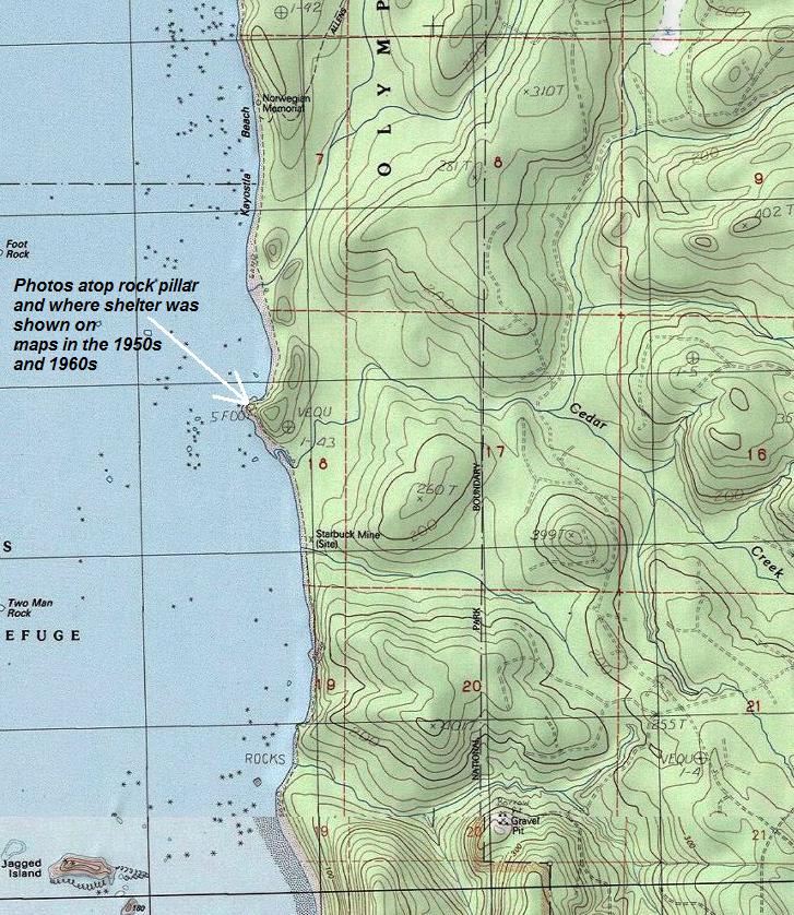
USGS 1956 Map (1963 edition) showing the shelter at the rocky knob north of Cedar Creek.
Showing the likely location for the Bald AWS site
Document says they ordered a 18x20 building and would require packing it in

At the end of 1942, the list still gave no section for this location in Township 29 North, Range 15 West.
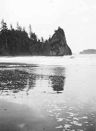
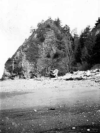
Photos of post taken during the war, structure on top of both images, taken from the north and south
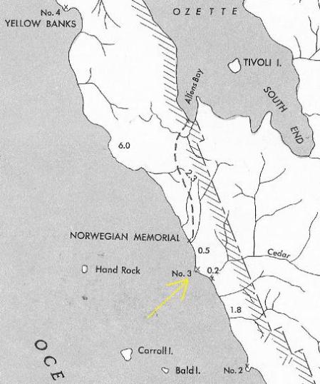
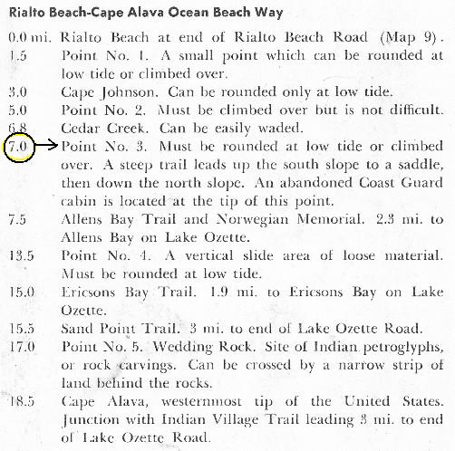
Also confirmed by Frederick Leissler in his guidebook "Roads and Trails of Olympic National Park" (UW Press, 1957) p. 52 "An abandoned Coast Guard cabin is located at the tip of this point." (Point 3 on his map 8) He also notes "old Coast Guard trail... is steep and rough" over that point.
Frederick Leissler guidebook - Roads and Trails of Olympic National Park
 <
<


 <
<