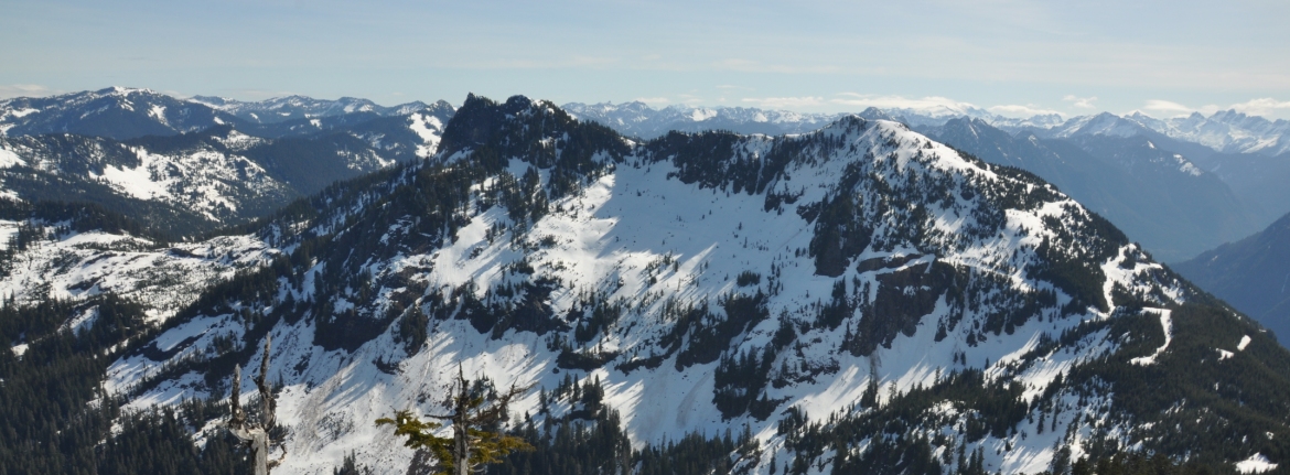
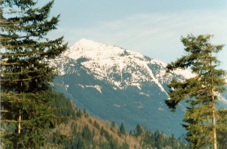
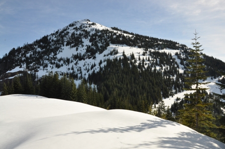
How can a class 5 rocky summit so close to the I-90 corridor have so few ascents? Answer: make the approach a boring 4,300 foot gain on a logging road. Bessemer has two summits. The more south summit is a popular winter or spring snow ascent. The views from there are spectacular that time of year when everything is blanketed in snow. But, to be successful at climbing the higher northern point, most would agree you'll need to go when the snow is gone. Unfortunately, there are many grander places to be in summer and fall than the Bessemer area. Only those who have been tantalized by it's mystery make the effort to forgo mightier summits for this hidden little gem.
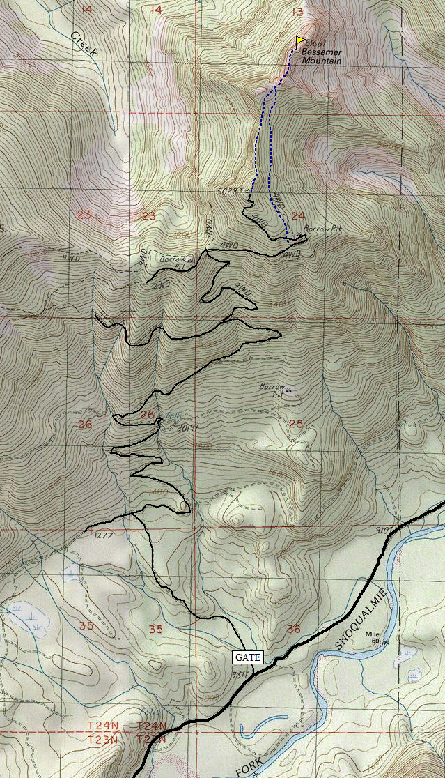
From Interstate 90 take Exit 34, turn left under the freeway, pass Seattle East Auto Truck Plaza, turn right on Middle Fork Road, and drive to the Mailbox Peak trailhead area. From there, it's about 4.6 miles to the Bessemer Gate. Park near but do not block the gate.
Bessemer Mountain
Distance: 8 miles
Elevation Gain: 4,300 feet
Summit Elevation: 5,166 feet
Access: Paved
WillhiteWeb.com

Access:
Bessemer Road Walk:
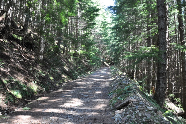
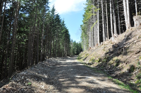
The Bessemer/ CCC Road-Trail trailhead has a locked gate at the paved Middle Fork Road but private trucks do use this road. Although it is State Lands, a company has an easement on this road for a private quarry up the mountain on some private lands. You may run into heavy trucks hauling out on this road. They are use to hikers, just smile and continue on. You might consider bringing a bike, at least for the first 1.5 miles which is easy riding. This popular road walk is pretty uninspiring but there have been many who have made this pilgrimage at least once, usually as a winter hike to the views near South Bessemer. Most agree, even if you only bring the bike for the first 1.5 miles of easy road, it would be worth it.
Our Bessemer Climb
We drove our selves to 4000 feet high on the ridge, thanks to a gate key. This put us only minutes below the southern Bessemer peak. From a forest road on South Bessemer's shoulder we dropped 300 feet in a long traverse to the North Summit's SE Ridge. From here we dropped North down steep slopes (hint: the closer you are to the North Summit massif the less steep it is) to the base of a gully heading towards the summit. This gully was probably 400 feet long and dripping with water in places. Soon it lead to the summit ridge.
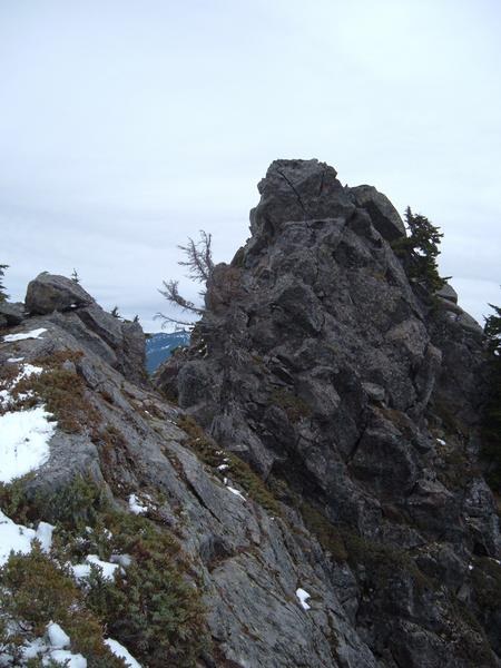
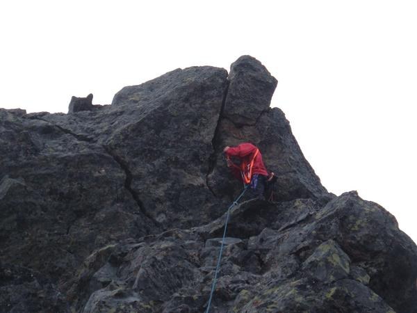
Travel north from here to where the ridge narrows drastically and the final summit block comes into view. We roped up here. Eric belayed me across the narrow bit to a clump of trees and a narrow gap where sat a excellent belay block. He followed across and belayed me as I lead the final 40 feet. There is a ledge about 10 feet below the summit from where you can climb right, as we did (5.5), or left(unknown?).
We signed the log, rap off the summit block, belayed back across the traverse, and started down. We rappelled once more near the bottom of the gulley over particularly wet terrain. On the way out we bagged South Bessemer, even though it doesn't have 400' of prominence.
Climbing the summit block
Bessemer summit area
Bessemer from Upper Blethen Lake
Bessemer from Quartz Mountain
A view of South Bessemer from the Middle Fork Road
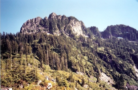
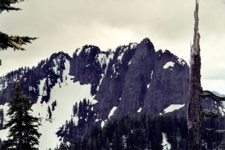
Bessemer Mountain
South Bessemer
Bessemer Mountain from Moolock Mountain
Bessemer Road
Bessemer Road
South Bessemer


