Mima Mounds Natural Area Preserve
Puget Sound Area Hiking
Distance: 0.5 to 2.5 miles
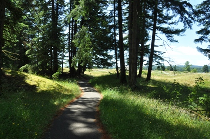
Access: Paved
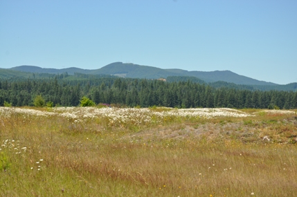
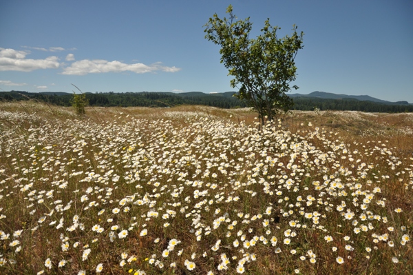
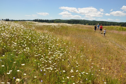
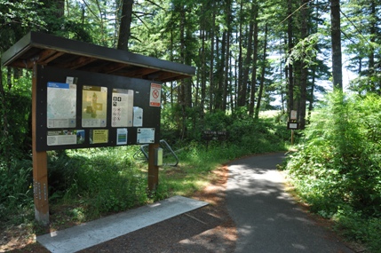
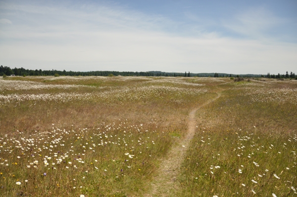
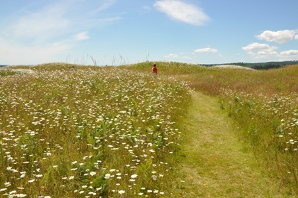
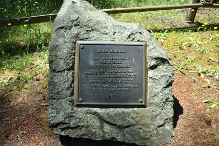
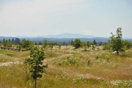
For a quick trip to a destination that couldn't possibly be in Western Washington, Mima Mounds is truly a wonder to behold. Wonder what Puget Prairie Grassland looks like? Does the word savannah even belong in our vocabulary here? Mima Mounds NAP preserves this most unique habitat, with the bonus of the mounds, a geological feature that nobody has positivity explained. The preserve was established in 1976 and has been maintained to preserve the small Garry oak trees, natural flowers and grasses that only repeated fires to the landscape could preserve. In 1966, the National Park Service designated Mima Mounds a National Natural Landmark as the site possesses exceptional value in illustrating the natural history of the United States. There are three main trail loops located around the mounds. One is paved for disabilities access, the other two are on nice packed dirt/grass. From the parking area is a short trail to the main viewing observation tower and information boards.
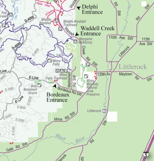
From Interstate 5, take Exit 95 and turn west on Highway 121 (Maytown Road SW) toward Littlerock. In Littlerock, continue west (forward past the school, past the intersection with Littlerock Road that curves south, and past the mini mart/gas station on the right) onto 128th Avenue. Travel about 0.8 mile where 128th Avenue ends at a 'T.' on top of the hill. Turn right onto Waddell Creek Road and travel about 1 mile. The entrance to Mima Mounds Natural Area Preserve will be on the left.
Access:
According to stories told by people of the Upper Chehalis Tribe, the Mima Mounds were left behind after a great flood subsided. "Thrush was a disgrace to the tribe: the people had noticed, for many years, that she would not wash her face or bathe; she would not go near the water...."My friends, Thrush would say, 'if I should wash my face, something might happen to this earth...' One day at last she consented to wash her face...Clouds started to form immediately...It rained and rained. The whole world flooded. There was nothing but prairie land beneath the water. .....At last the water fell...(near Mima Prairie) the earth still remains in the shape of waves. It extends like this for four or five miles.
A Story From The First People
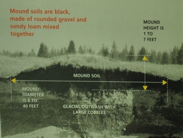
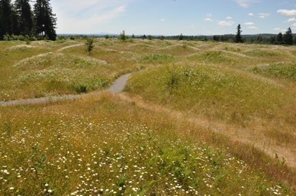
Mounded landscapes are found in several areas of North America and in a variety of habitats. They are called pimple mounds near the Gulf of Mexico, prairie mounds in teh northern Great Plains, and hogwallow mounds in California. Mounds in each location may have a unique origin. In South Puget Sound, Mima Mounds are located only on top of layered sediment deposited by glacier meltwater. They appear to be restricted to a single terrace level along the Deschutes River south of Olympia. Mounds are circular or elliptical 8 to 10 mounds per acre. Mounds are usually about the same size and shape in any one area, but some very low mounds are found among larger mounds.
What is a Mima Mound?
On May 20, 1841 Charles Wilkes, commander of the United States Exploring Expedition from 1838 to 1842, thought the Mima mounds might be burial sites: "Being anxious to ascertain if they contained any relics, I subsequently visited these prairies, and opened three of the mounds, but nothing was found in them but a pavement of round stones."
In April 1840 Sir James Douglas of the Hudson's Bay Company at Fort Vancouver, traveled through mounded prairies in the region. "In short the whole aspect of the Plain, its sinuous banks, the larger and smaller knolls, its slope towards the Chehaylis river and the oral tradition fo the Natives, unite in strengthening the opinion that it has in some former period much more recent than the deluge belonged to the region of waters."
April 6, 1847 Artist-explorer Paul Kane traveled in western North America from 1845-1848. "This evening we encamped in the Prairie de Bute. This is remarkable ofr having innumerable round elevatons, touching each other like so many hemispheres...I traveled twenty-two miles through this extraordinary looking prairie."
1853-1854 James Graham Cooper did field work in this area for the Pacific Railroad Surveys. "I would suggest they may have been produced by eddies and whirpools, probably at a time when this sound formed the estuary of a great river like the Columbia, or perhaps were branches of the great system of northwest sounds which extends from the Columbia River to Sitka, or further."
Early Encounters, Early Hypotheses
About 2.2 million years ago as earth's climate cooled, massive ice sheets formed far to the north. These glaciers advanced southward and melted northward many times. Thousands of feet thick, they gouged the underlying land and picked up immense loads of gravel and rock. The last advance of ice into western Washington ended about 16,500 years ago. Mima Prairie is at the edge of its southernmost reach. As the glaciers retreated, torrents of meltwater fanned across the landscape and deposited a load of gravel adn rock. This gravelly outwash became the well-drained, dry soils of today's prairies.
Evidence of Ice Ages Beneath The Mounds
More than 30 explanations have been proposed for the origin of the Mima Mounds, but non has been proven.
Were the Mounds Created by Glacial Ice?
In 1913 glacial geologist J Harlan Bretz completed the first detailed study of the Mima Mounds. Bretz suggested that gravel, stones and soil washed onto the melting ice age glacier might have collected in pits, called suncups. As the ice melted, the sediment pits would have settled in mounded shapes.
Created by Earthquakes?
Andrew Berg suggested that mounds might form when earthquakes generate vibrational shock waves that travel through the soil. In this hypothesis, the soil would move the most where wave peaks intersect with each other, and tend to collect as mounds in the places where the waves cancel each other out.
Origin of Mound Sediments?
Some scientists have proposed that the Mima Mounds are made of deposits from sediment rich floods from a glacially dammed lake. Other scientists added a new twist by suggesting that the mounds are sediment that collected where the water flowed around vegetation. Their views are known as fluvial deposition hypothesis.
Caused by Erosion?
Explorers and scientists since the mid-1800s have proposed a variety of mound hypotheses based on erosion from glacial meltwater. In 1988 glaciologist A.L. Washburn reviewed the evidence for and against all the mound hypotheses to date. He favored hypotheses based on runoff erosion with gegetation anchoring. In these hypotheses, runoff from glacial meltwater eroded the soil between trees or shrubs, leaving mounds around the plants.
The Work of Small Pocket Gophers?
In the 1940s Walter Dalquest and Victor Scheffer proposed that the mounds were formed by pocket gophers excavating nest chambers. Several scientists continue to work on this hypothesis today. They suggest that after the glaciers retreated and vegetation grew on the thin soil, pocket gophers came in from unglaciated country. The gophers began to dig nest chambers, but encountered the dense layer of glacial debris beneath the soil. They moved soil and pebbles upward, forming a mound. Pocket gophers are territorial; the center of each mound is the center of a pocket gopher's territory.
The Result of Permafrost Cracking?
This explanation suggests that frozen ground (or permafrost) at the end of the glacier cracked into many sided shapes. Ice formed wedges in the cracks. As the climate warmed and the ice melted, the soil was left in mounded shapes.
Scientists Still Search for an Answer
The Mima Mounds were formed some time after ice age glaciers began receding 16,500 years ago. Their origin has puzzled scientists and curious visitors since the mid-1800's. Research has revealed what we know so far about the glacial history of this area and the structure and pattern of the mounds.
What We Know For Sure
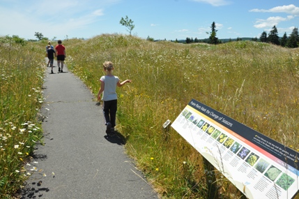
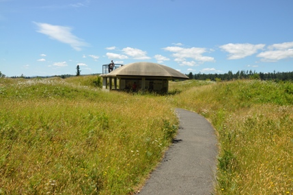

Lookout structure and interpretive area
View from lookout structure
Capitol Forest
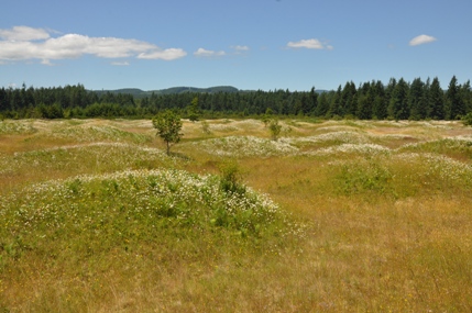
Mounds in the trees
Garry Oak Trees
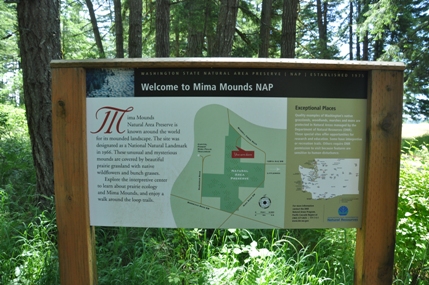
Welcome to Mima Mounds NAP
Registered Natural Landmark
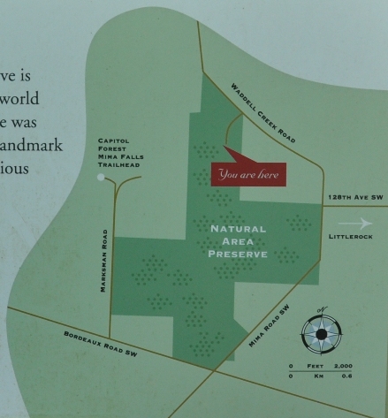
Trailhead map of the area
Mound Profile
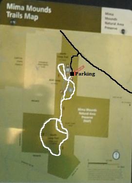
Trails at Mima Mounds - A paved loop near the parking area, a small North Loop and a large South Loop (with cut-off trail).


