Dayton Peak is not very high but given the location of Dayton, you will think you are looking at airplane views. The land drops in most directions for a long, long way. Given the grand distance, Dayton Peak once had a lookout, a very large lookout.
WillhiteWeb.com
Dayton Peak Lookout
Distance: 3 miles one-way
Summit Elevation: 1,013 and 1,066 feet
Elevation Gain: 700 feet, 200 on return
Access: Any vehicle to trail start at gate
Access:
Route:
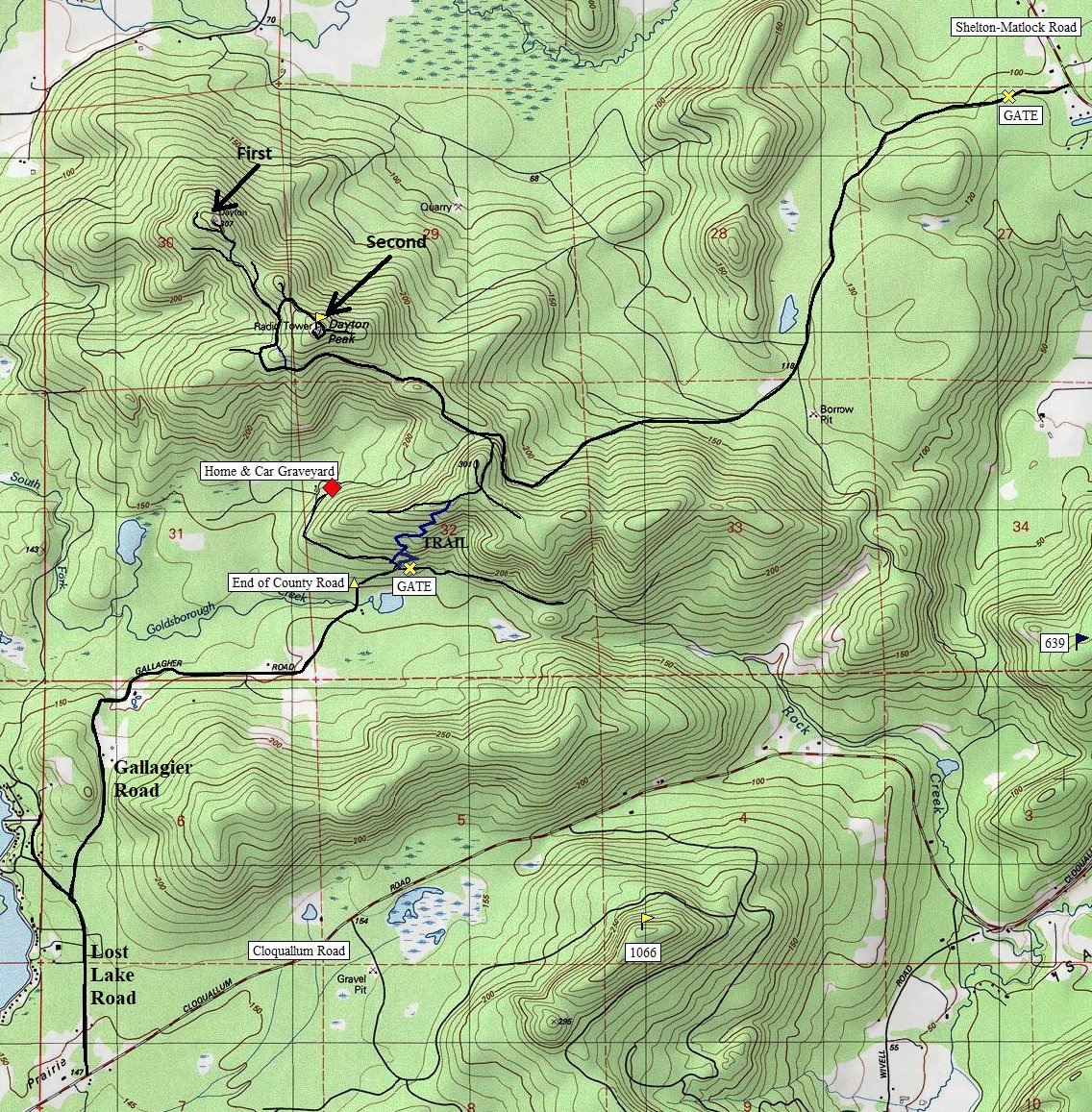
From this Y area near the gate, look for a overgrowing trail going up into the timber. Follow it 2 minutes to a old logging road. Turn left on the old road (trail goes left and right). Follow road uphill, making one switchback, continue up looking for a trail on the left. If you hit a camp fire ring and the end of the road you are too far. Follow the hidden left trail going up (another trail will come up and merge onto your trail. Keep hiking uphill, the overgrowing trail and soon you hit the road system at the top of the ridge. Follow the road to a 4 way intersection. Continue straight dropping downhill loosing 200 feet to the Dayton Peak mainline. Stay on ridge and follow to the summits using map or GPS. I did this route in 2012 and 2020.
Permits are now required on most roads that lead to the top but you can gain access via an old trail if you choose. To reach the south side of the mountain, find your way west on the Cloquallum Road out of the Shelton area. (There is no interchange off Highway 101). Turn north on Lost Lake Road, then right at a Y onto Gallagher Road. Pass many homes and come to a "End of County Maintenance" sign. Not far beyond this sign is a large Y intersection. Park Here. There is a gate on the right. The road continues left to a private home.
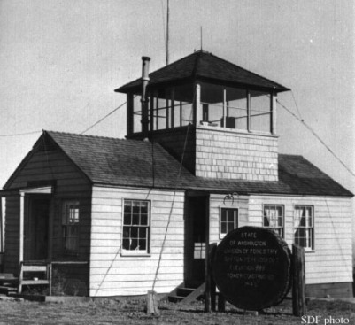
1946
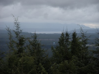
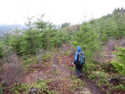
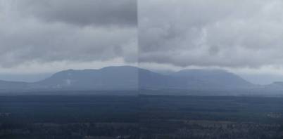
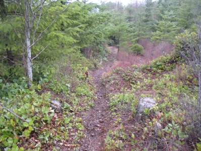
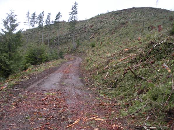
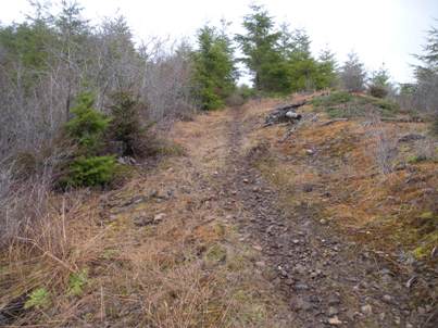
Back down the trail. These trees are now twice as large.
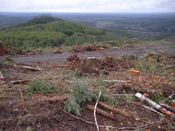
Looking north to Dow Mountain
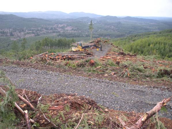
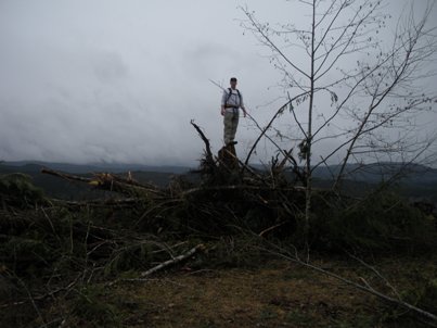
Harvesting timber at the summit March 2012 (the due west ridge off the summit)
The road goes just under the summit.....on the right there...as it works around to the top
On the trail, now more brushy.
Motorcycle trail
Highest point is now some logging debris
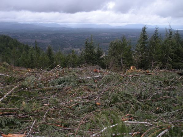
The Great Bend of Hood Canal
Views from the summit
Views from the summit
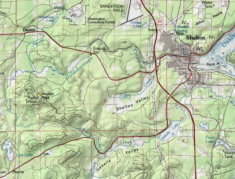
Dayton Peak Area Map
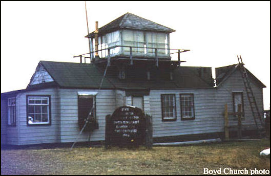
1957

2-9 Lost Lake, State of Washington, structure on private land, newly constructed with AWS funds, retain for State of Washington, 14 x 32 cabin built with AWS funds.
Below: AWS document list showing what to do with stations after war is over. Lost Lake structure was transported to Dayton Peak from Lost Lake Hills.
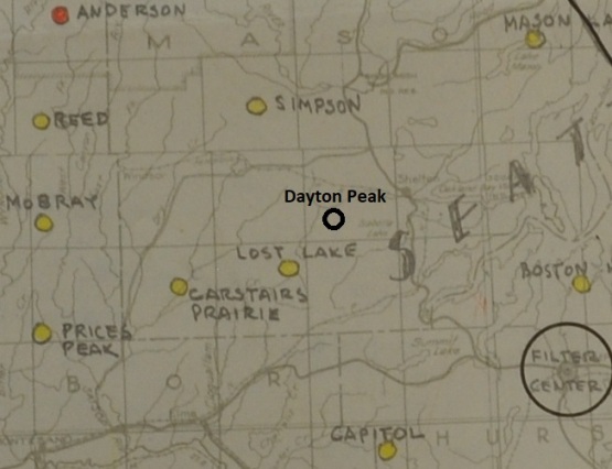
AWS map showning location of Lost Lake Hills AWS site. I have added in the Dayton Peak circle and label where Dayton is located.
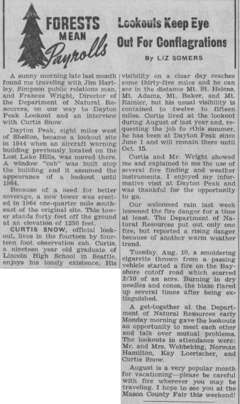
Shelton Mason County Journal - August 19, 1965 (one year after new tower in new location)
A sunny morning late last month found me traveling with Jim Hartley, Simpson public relations man, and Frances Wright, Director of the Department of Natural Resources, on our way to Dayton Peak Lookout and an interview with Curtis Snow. Dayton Peak, eight miles west of Shelton, became a lookout site in 1944 when an aircraft warning building previously located on the Lost Lake Hills, was moved there. A window cab was built atop the building and it assumed the appearance of a lookout until 1964. Because of a need for better coverage, a new tower was erected in 1964 one-quarter mile south-east of the original site. This tower stands forty feet off the ground at an elevation of 1250 feet.
Curtis Snow, official lookout, lives in the fourteen by fourteen foot observation cab. Curtis, a nineteen year old graduate of Lincoln High School in Seattle, enjoys his lonely existence. His visibility on a clear day reaches some thirty-five miles and he can see in the distance Mt. St. Helens, Mt. Adams, Mt. Baker, and Mt. Rainier, but his usual visibility is contained to twelve to fifteen miles. Curtis lived at the lookout during August of last year and requesting the job for this summer, he has been at Dayton Peak since June 1 and will remain there until October 15. Curtis and Mr. Wright showed me and explained to me the use of several fire finding and weather instruments. I enjoyed my informative visit at Dayton Peak and was thankful for the opportunity to go. Our welcomed rain last week lessened the fire danger for a time at least. The Department of Natural Resources put out only one fire, but reported a rising danger because of another warm weather trend.
Tuesday, Aug 10, a smoldering cigarette thrown from a passing vehicle started a fire on the Bayshore cutoff road which scarred 2/10 of an acre. Burning in dry needles and cones, the blaze flared up several times after being extinguished. A get-together at the Department of Natural Resources early Monday morning gave the lookouts an opportunity to meet each other and talk over mutual problems. The lookouts in attendance were: Mr. and Mrs. Webbeking, Norman Hamilton, Kay Loertscher, and Curtis Snow.
Lookout History:
In 1944, an aircraft warning building 14 x 32 foot crew station was relocated from the nearby Lost Lake Hills to Dayton Peak. The following year in the summer of 1945, a 10x10 room was built on top for observation. The lookout person was Gerald (Jerry) Needham who gave the following account: Stephie and I moved to Dayton Peak with our family of four children in May, 1945. At that time, it was a two-room A.W.S. building. The six of us were right real cozy, that is for sure. Stephie did all her good pastry and bread baking on a small Lang wood burner, got sorta warm in here during the hot August days. In 1945, during the summer, a 10x10 room was built on top of this A.W.S. as the Lookout. We had a hay-wire phone line that worked, sometimes. In 1948, with a lot of co-operating between the P.U.D. Commissioners and the District Warden, Mr. Herb Grell, I was able to get Public Power at this Station. On September 21, 1948 the switch was pulled, and Dayton Peak had the honor of being the first Division of Forestry lookout to have public power. We had the pleasure of lights, refrigerator cool electric cooking and all the other conveniences that go with electricity. In 1953, a 5,000-gallon cistern for catching rainwater and a two-bedroom and bath was built on to match the original.
In 1964, the building was replaced with a standard 40-foot timber tower with live-in DNR cab. This new DNR tower was placed one-quarter mile south-east of the original site for better viewing. This new tower was removed in 1969.
USGS Notes (there is a USGS Benchmark at the first location):
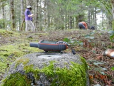
In 1954, the USGS placed a benchmark at the original lookout site, describing the station at the northwest end of the ridge, at the state forest service lookout house, Dayton Peak. The benchmark was placed 35 feet from the northwest corner of the lookout house while a directional benchmark was 65 feet northwest of the lookout house. They describe the lookout as a state forest service lookout 60 feet by 20 feet wooden structure which has a second story, the observation tower, near the center of the building. From the center of the apex of the roof to the benchmark was 68.49 feet.
Lookout Locations
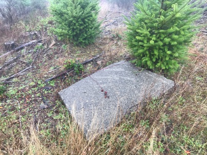
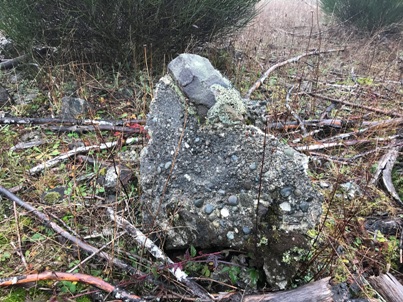
Everyone is in agreement that the first lookout was at the benchmark location on the Northwest peak. There is a middle peak and the main highest Southeast peak with the Dayton Peak name and radio tower sometimes listed. When the new tower was constructed one-quarter mile south-east for better coverage, it is assumed that the new site was on the highest point, Dayton Peak proper. The actual distance between the original site and the highest point is more like a half mile. We checked the middle summit but no artifacts were found, nor was there any level place that appeared to have a lookout building. On the highest summit, Dayton Peak, there are concrete chunks but it is not clear if these are from the lookout tower or the radio tower that once stood on the summit. There is also a ridge that extends off the summit due west that would make a good view. This ridge ends at a huge logging landing and nothing could be found there.
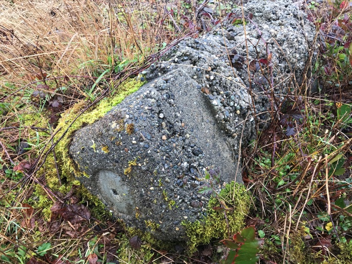
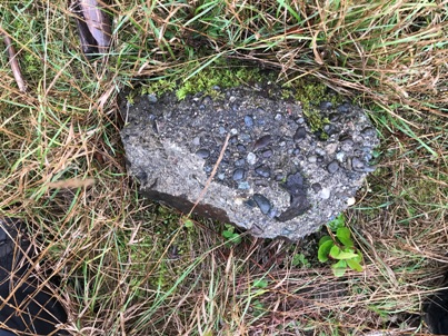
Concrete piece at the summit location
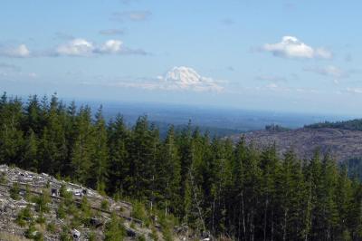
Rainier view (photo by Ralph Owen)
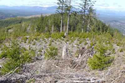
Original site view (photo by Ralph Owen)
USGS benchmark with missing disk and entire anchor pulled out of the ground and on its side.
Slab of concrete for the radio tower or lookout, unknown.
Concrete at the highpoint Dayton Peak site.
The benchmark still in place and prior to tree harvest
(Photo by landrover)
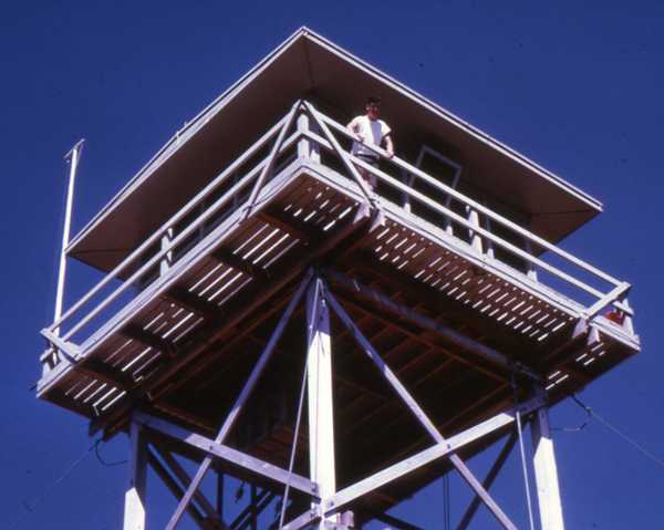
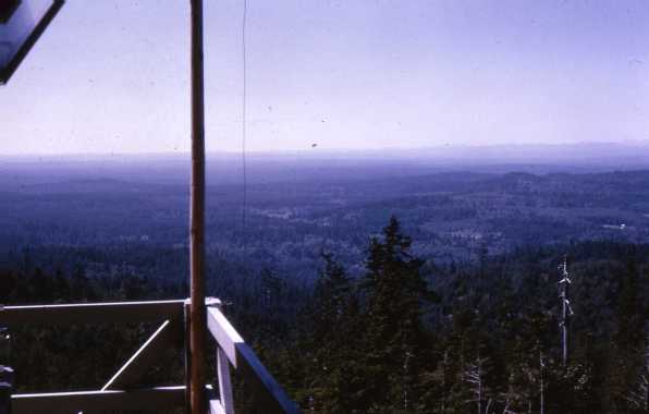
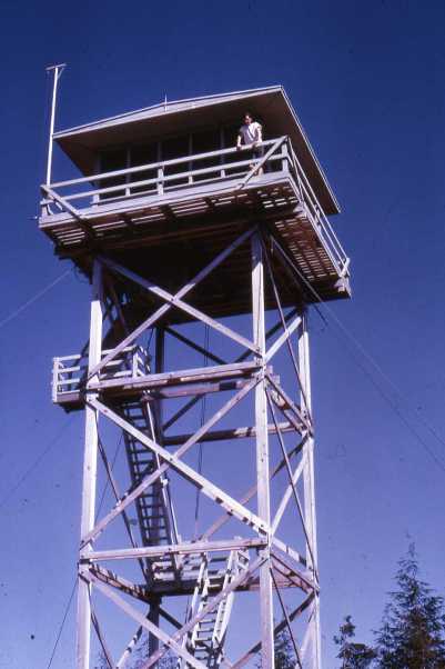
The second lookout in 1965, photo by Dave Wood (relief lookout that summer)
The second lookout view in 1965, photo by Dave Wood (relief lookout that summer)
From the article above in the Shelton Mason County Journal - August 19, 1965
Dayton Lookout in 1965, photo by Dave Wood


