The ultimate road trip in North America is the Canadian-Alaska Highway or Alcan Highway. If you live in the United States, your journey will be over 2,300 miles one-way through some of the most dramatic scenery on the continent. The majority of this route (1,500 miles of it) was built in 1942 in seven months as a supply route to military forces in Alaska during World War II. The U.S. feared that Japan might invade Alaska, after they bombed Pearl Harbor. Now the road is a major supply line to Alaska as well as one of the greatest road trip vacations.
The route can also include some spectacular side trips. On the way to the official start of the highway, we visited Glacier, Yoho, Banff and Jasper National Parks in British Columbia and Alberta Canada. While in the Yukon Canada, we took a two day side trip and drove the Dempster Highway to the Arctic Circle. When we returned to the U.S., we took the Cassiar Highway in the British Columbia Coastal Ranges back down to Seattle.
The scenic drives, historic sights and the cities are just the start. Other adventures we included on our trip were climbing several mountains, an overnight hike in Denali National Park and hiking the famous 33 mile Chilkoot Trail. We visited Fairbanks, Anchorage and Skagway areas as well. Alaska is huge, there is plenty left up there to see.
You will have ultimate bragging rights when talking with friends about road trips. My brother set the family record during one of his driving shifts, passing 10 RVs in one pass! We did the trip from Seattle. From Seattle to Fairbanks is 2,313 miles, another 358 down to Anchorage, and 2,435 miles back. Include 500 miles to the Arctic Circle and back, plus the starting deviation doodle over to Alberta and we put well over 6,000 miles on a vehicle.
The highway is paved but there are always areas of construction or repaving. Several sections could have loose and dusty gravel. Expect to get at least one major ding in your windshield. Below are some of the sights we saw other than all the window gawking:
Start of the Highway is in Dawson Creek, BC
A Bear on the side of the road
Watson Lake's Signpost Forest
Muncho Lake
Tutshi Lake
Skagway, Alaska
Camping at Lake Laberge
Matanuska Glacier from Highway 1
Views on the Cassiar Highway
Camping at Summit Pass
Alaska Highway
WillhiteWeb - Travel
Driving along Muncho Lake
Going north from Dawson Creek you begin to wonder, "Where are the great mountains you came to see"
Views from the Dempster Highway
Views from the Dempster Highway
Views on the Cassiar Highway
No, he's not dancing on the Arctic Circle; the mosquitoes are just attacking him as he reads the information boards
Entering Alaska on the "Top of the World Highway"
Made it to the Arctic Circle in a Geo Prism!
Looks like a nice place to picnic..except 1.5 million mosquitoes in the area
North Pole, Alaska
Worlds Largest Tree Crusher, Mackenzie B.C.
Historic Skagway, Alaska
On September 24, 1942, soldiers from the two regiments met here, completing the southern section of the highway
Dawson Creek, British Columbia
This is the official start of the Alaska Highway since road construction started here in 1942. A stop at the starting point sign is traditional.
Stone Mountain Provincial Park
You will drive 350 miles from Dawson Creek before you hit the mountains. When you do, it will be Stone Mountain Provincial Park, a great place to camp. We set up camp around 9 p.m. and still had time to hike up to Summit Peak, an easy trail right off the highway. We returned to camp at midnight, still in daylight! Summit Lake Pass is the highest point on the Alaska Highway at 4,250 feet.
Muncho Lake Provincial Park
The next park is Muncho Lake Provincial Park, a great place for photo opportunities with interesting geologic mountains, jade-colored water and plenty of wildlife.
Watson Lake Signpost Forest
You will enter the Yukon near Watson Lake. Stop at the Signpost Forest. Walk among 60,000 road signs and various others all mounted in a labyrinth. I guarantee you will find one from near your home and wonder who put it there and why? It is said the first sign was put up by a homesick road builder.
Skagway Side Trip
A must do side trip off the Alaska Highway (just before Whitehorse) is driving down Highway 2 to Skagway. If you can, hike the Chilkoot Trail, if not, take the White Pass and Yukon Route Scenic Railway, a narrow-gauge line considered one of the best rail rides in the world. Heck, why not book a helicopter tour over Glacier Bay, one of the most amazing and remote National Parks anywhere. In Skagway, you can do a self-guided walking tour through the historic district.
Whitehorse
Imagine gold rush days when 100,000 people came through this town. This is the capital of the Yukon Territory and a good place to stock up on supplies. Shortly after Whitehorse, there are two options for travelers. The Alaskan Highway continues on Highway 1 to Tok Alaska, then on toward Fairbanks. To see more if you are coming back that way, take the Klondike Highway for additional sights and scenery. Taking the Klondike Highway is necessary if you want to drive the Dempster Highway to the Arctic Circle.
Dempster Highway
For this adventure, you must get fuel at the Klondike-Dempster Highway turnoff. A full tank will get you to the Arctic Circle. If there is no gas is at the station there....you are stuck until it arrives. The Dempster highways gravel berm insulates the permafrost in the soil underneath. The thickness of the gravel pad ranges from four to eight feet in places. Without the pad, the permafrost would melt and the road would sink into the ground. The Dempster is the only public highway in North America that crosses the Arctic Circle. One could even travel several hundred miles further north to Inuvik. Once back at the Klondike Highway, return back to the Alaska Highway via the Top of the World Highway, arriving back near Tok (Alaskas major crossroads town).
Tok
Not much to see here but there are lots of state and private campgrounds available.
Fairbanks
So the highlight of Fairbanks is to say you been there. When asked what I saw in Fairbanks, I usually respond with Taco Bell.
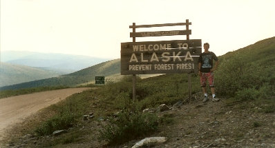
Alaska
Now that you made it to Alaska, you have to see Alaska in an entire trip unto itself. Although I will not go much into it, a simple look at an Alaska road map shows your basic route would continue south from Fairbanks to Denali National Park, then to Anchorage and the coastal towns to the south.
Cassiar Highway
It took us 3 days to drive home via the Cassiar Highway from Anchorage to Seattle. The Cassiar is a shorter route for those living on the West Coast but sometimes slower road speeds. We did not stop much as the weather was awful.


Welcome to Yukon sign


Portage Lake south of Anchorage off Hwy 1


