

North Baldy Mountain Lookout Site
In 1909, North Baldy had a lookout, with a camp 1/4 mile south of the summit.
In 1918, a log cabin was built.
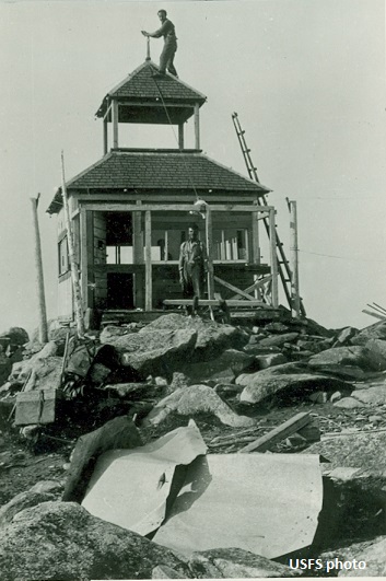
In 1928, a cupola cabin was built.
In 1930, the Newport Miner newspaper had the following story that is similar but a bit different than the story that Kresek shares in his book, reported as 1928 with different individuals. One or both happened. A new emergency landing field for forest patrol planes will probably be improved as the result of a forced landing made Sunday afternoon by Lieut. E.C. Bigelow, pilot with A.N. Cochrell of the Kaniksu Forest as observer. About twenty minutes after the plane left Newport the timing gear broke and the motor stopped. The plane was at an elevation of about 6400 feet and not much more than 100 feet above the lookout station on North Baldy Mountain, when the engine stopped and a forced landing was inevitable. The pilot dove for the mountain side and nearing it shot upward sharply, making a perfect 3-point landing on a bunch grass slope at about a 50 per cent grade. The lookout on North Baldy was phoning to Supervisor Ryan at the moment and reported the plane in distress and falling, and as it disappeared from his view down the side of the mountain, he excitedly reported, they are gone, and it was a great relief to Mr. Ryan a few minutes later when the lookout reported that he could see the flyers walking to his station. Lieut. Dwight Smith flew out from Felts Field with needed repairs and Mechanic Ray Schreck was taken out over the trail to the mountain top. Additional parts were sent for Monday and early Tuesday morning Pilot Bigelow was able to take off and brought out both Cochrell and the Mechanic. Mr. Cochrell says that no trouble was experienced in taking off from the mountain top and that in the bunch grass area that gives the mountain the name Baldy there is room for several landings and that take-off runs of 1500 feet can be improved at slight expense.
In 1933, the USGS placed a benchmark at the summit.
In 1936 (July 9), the Newport Miner news reported visitors to the North Baldy Lookout as Allen Piper and Billy Cole.
In 1938, a 40-foot pole tower with an L-4 cab was built.
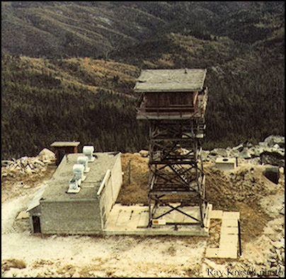
In 1957, the U.S. Air Force acquired 56.5 acres from the Forest Service and the Northern Pacific Railway to be used as an unmanned Gap Filler radar site. Constructed on the site was a concrete block communications building (19 x 39 feet), a partly buried fuel tank, an outhouse and a steel radar tower.
In 1960, the USGS had in some notes that the lookout tower had been rebuilt. They are referencing the 1938 tower since the one referenced in the 1933 benchmark notes (the cupola) was now gone.
In 1961, the Air Force declared the site as excess inventory and the property was returned to the Forest Service the following year in 1962.
In 1964, a 41-foot timber tower with R-6 flat cab was built. (The new tower was not on the footings of the 1938 tower).
In the 1970s, the lookout was abandoned. Over time, the tower lost its guy cables and lightning hardware.
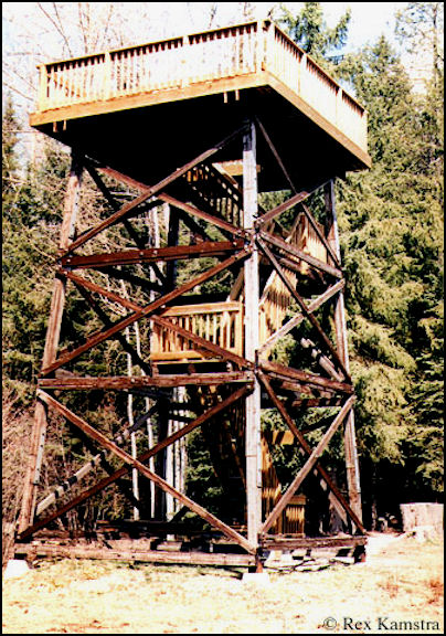
In 1989, the tower was torn down. The top 30 feet of the structure was moved to Big Meadow Lake west of Ione, WA, to become a wildlife observation tower.
WillhiteWeb.com
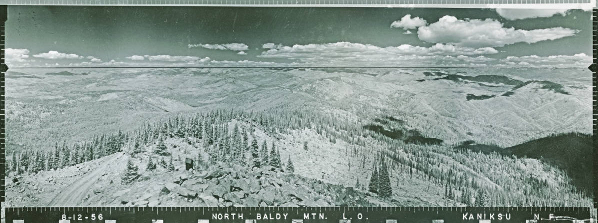
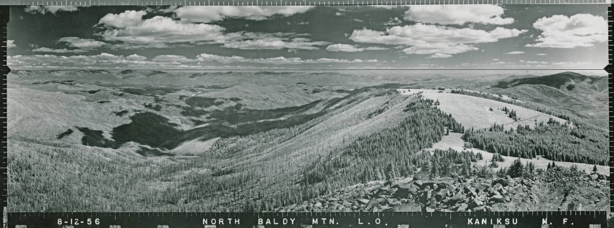
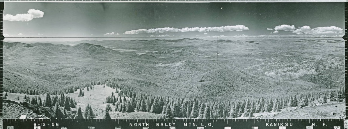
Looking North 1956
Looking Southeast 1956
Looking Southwest 1956
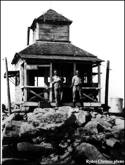
1933 North Baldy Lookout cupola
Elevation: 6,173 feet
Hiking Distance: Drive up
Elevation Gain: Drive up
Prominence: 2,173 feet
County: Pend Oreille
Access: High clearance 4WD to reach summit.

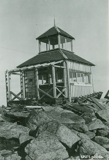
North Baldy Lookout cupola, 2 photos labeled as 1925
1983 North Baldy Lookout R-6 Flat Cab
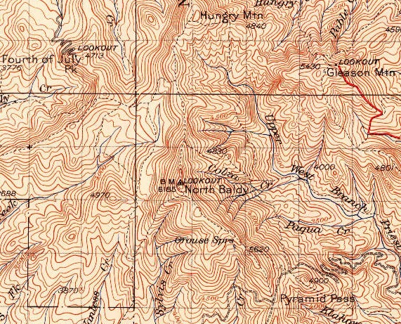
1942 USGS (1958 Update)
Top 30 feet of the structure that was moved to Big Meadow Lake
North Baldy is a popular hiking destination even though a road goes all the way to the summit. Since the road gets pretty rough in the final mile, most walk the road anyway. With wide meadows and flowers in early summer, this high mountain is one of the best in the area. The mountain is also the 114th most prominent mountain in Washington, views area quite expansive.
Lookout History
A road does go all the way to the summit but I would not recommend driving the final mile, it is super rocky.
Route and Site Information:
Driving up with the summit in view
View North
View Northeast with Priest Lake in the distance
Sunset June 2023
South Baldy
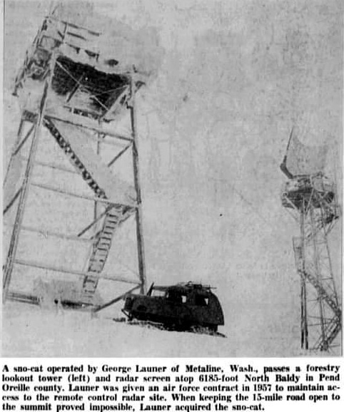
Right: 1959 image from the Spokane Chronicle shows the 1938 lookout tower as well as the Gap-Radar
More relocation info found:


