
At the south end of the Onaqui Mountains (i.e. Stooky Benchmark range), are 3 small low elevation peaks, Little Mountain, 7500 and 7340. These three peaks make for a great early spring snowshoe trip. As always for many of the western desert peaks, low elevation still can mean big views. The loop also passes some big juniper trees that make it a bit more interesting than some other hikes in the area.
Head out on the Pony Express road past the Vernon area. Just before climbing up to Lookout Pass, you'll see a siren that looks like a cell tower (shown on map). Just east of the siren, follow a dirt road north 1.3 miles to a cattle guard. Once across, the road splits. The left fork goes around the south end of Little Mountain. This road is really rough and I didn't even attempt it. One could easily climb Little Mountain from this point. Taking the right fork, the road goes north along Little Mountain heading for Rock Canyon. (I went 1.5 miles past the cattle guard and parked). Several roads lead off in each direction. Some may even be better access points. If you can find the very long straight road between Little Mountain and peak 7500, you'll find the best location for a loop. Low clearance vehicles will want to park on the Rock Canyon Road, near to where I show on the map. In spring, the roads may be very rutted but I believe the road is usually graded.
South Onaqui Loop
Distance: 5 mile loop or less
Elevation Gain: 2,440 feet round trip or less depending on route
Summit Elevations: 7,500, 7,340 & 6,696 feet
Access rating: Level 2 or 3
www.WillhiteWeb.com: Your online resource for hiking, climbing and travel
Access:
My route didn't have any obstacles. There are a few cliff bands on all 3 peaks but nothing too large or blocking. The southern end of the loop was the northern extent of a big fire a few years ago so it's interesting to see the before and after. The south faces were melted out when I went so that explains why I dropped a bit of extra elevation on the south end of the route (there is a higher pass but I forgot my snowshoes).
Route:
Little Mountain
Peak 7500 "Rock Canyon Peak"
Peak 7340 "Lookout Pass North Peak"


Long road to the base of "Lookout Pass North Peak"
From the east on the Pony Express Road

Upper east ridge of "Rock Canyon Peak"

View south from "Rock Canyon Peak"
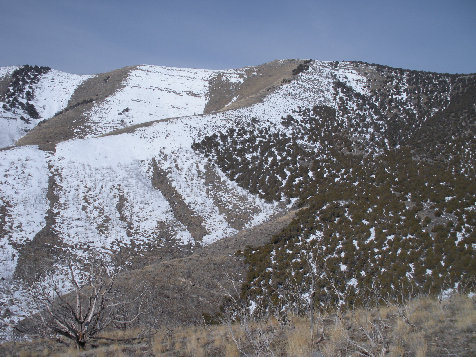
"Lookout Pass North Peak"
Indian Peaks
Round Top/Davis Peaks
Black Crook Peak
Sabie Mountain
Red Pine Mountain
Little Mountain

Looking north at the Onaqui Mountains and the Stansbury Mountains


Indian Peaks
Cedar Range in the far distance to the NW
SE ridge of peak 7340 "Lookout Pass North Peak"
South from the summit of 7340 and the end point of the fire


Peak 7500 "Rock Canyon Peak" from Little Mountain summit
Ridge on top of Little Mountain
Little Mountain from 7340 "Lookout Pass North Peak"
7340 "Lookout Pass North Peak" from Little Mountain
4 way