Owl Ridge AWS Site
WillhiteWeb.com
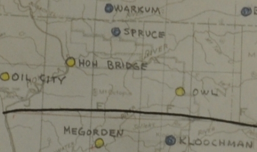
Owl Ridge station was located on the boundary between Olympic National Park and Olympic National Forest. Built for the Aircraft Warning Service (AWS) in 1942, this site was needed since no existing fire lookout existed between the Spruce and Kloochman Rock fire lookouts. Both Spruce and Kloochman were being utilized by the AWS. I probably have the most backstory on Owl Ridge than any other AWS site. I will write out the story below, most is word for word but I will abridge in my own words a few spots. I have the original documents if you want to see one.
Lookout Elevation: Around 3,500 feet
Hiking Distance: Under a half mile
Elevation Gain: 300 feet
Access: Fair dirt roads
June 10, 1942 Letter from M.L. Merritt, AWS Liaison Officer to Hill Jones, State Supervisor of Forestry.
The Fighter Command have advised that they desire an additional observation post located somewhere midway between Kloochman Rock and Spruce (Geodetic Hill) on the west side of the Olympic Peninsula. This has been discussed informally with Hill Jones, Frankland, and also with the Fighter Command. The Fighter Command advise that this general location is apparently satisfactory if a suitable spot can be secured. Hill Jones has already requested his local representative to take a field trip into the center of T. 26N., R.11 W. to see if an open hill is available. Preliminary discussion over the phone with his local representative indicated that practically all of the hills in that area are timber covered, and that there might be difficulty in securing a suitable location. The State have brushed out a road extension reaching approximately to the south quarter corner of Section 5, T25N, R11W and they plan on building a telephone line up that road from the Clearwater River across to the Hoh River, going down Maple Creek on the north side. Such a telephone line when completed would be switched at Clearwater where there is a commercial center and would pass somewhere near the possible observation point. How soon will be completed is problematical. Apparently, it would be necessary to man the station with radio if occupied immediately. Mr. Jones will report as soon as practicable, giving what information is obtainable and some estimate of the cost and type of improvements required. No further action will be taken until his report is received.
Warden Norbit Megorden reported last night on his trip to attempt to determine possible new sites for AWS in his district, outlining the following points:
1. The suggested site in Section 22-26N-11W proved to unsatisfactory. It is covered with heavy timber requiring extensive felling operations before satisfactory clearance could be obtained. The point is a long distance from any water with consequent difficulty in servicing the observation men properly. It is further from the trail than indicated on the maps.
2. Warden Megorden believes a satisfactory point could be found on a hill about 1500 feet in elevation in the NE of the NE of Section 17-25N-11W where he thought that one set of fallers could clear the necessary timber (15M feet of live timber) and snags to afford the necessary clearance for observation. This point is about one and one half miles from his mothers home on the Clearwater River and is reached by an old trail. The telephone construction would follow this trail to connect with the Clearwater Telephone line which follows the road up the Clearwater to just beyond the Snahapish Bridge. Water is nearby and the servicing would be less difficult than on the first site.
3. On Owl Ridge on the line between Secs. 11 and 14-26N-10W, there is a rocky point found while fighting lightning fires last summer. This he feels, could be made suitable easily as the timber is sparse on the ridge. However, it is 10 miles by trail and then six more miles through the woods from the end of the Hoh Road so that servicing would be difficult. Nothing is known as to water conditions nearby. Elevation 3400. Owl Mtn is almost due north of Kloochman Rock about seven miles.
4 and 5) He makes a few more suggestions, ending with “We will be glad to scout further for information for you on any of the above points.”
June 12, 1942, Hill Jones responds to M. L. Merritt about the additional lookout site needed.
I am not surprised that the first point suggested is unsatisfactory on account of heavy timber. The Fighter Command do not believe that the location about 1.5 miles above Warden Negordens place on the Clearwater River will be satisfactory, since it is too far out of the line between Kloochman and Spruce. Apparently, however, the suggested point on Owl Ridge on the line between Sections 11 and 14 is a satisfactory general location. I explained to the Fighter Command the difficulty of finding a place there on account of the heavy timber and I think they understand it. They would like, therefore, to have you make a more complete field reconnaissance of the Owl Ridge location, reporting to us on its suitability, and for the information of Mr. Frankland on the cost of development by phone, trail or radio. If radio is used it would require additional personnel which is not too desirable, and in any event the Fighter Command prefer telephones because of the chance of unauthorized persons picking up radio messages. One thing which should be reported regarding the Owl Ridge location is whether there is visibility in all directions and particularly whether the observer there will be able to see Spruce and Kloochman after necessary timber falling is done. Mr. Frankland told me informally that if there were additional expenses involved because of investigations of this kind, he could meet the cost. It is requested, therefore, if any such expenses are incurred you write direct to him in regard to them. I am advising him by copy of this memo. If on scouting you can find still more suitable location in the general region of the Owl Ridge site, it will I am sure be acceptable to the Fighter Command since what they want is the best site available, and if possible one that will cover visibly the area between Spruce and Kloochman.
June 15, 1942 M.L. Merritt responds to Hill Jones
On June 23, I crossed the Hoh River below the South Fork then crossed the South Fork on a log jam a then followed the old Forest Service trail up the South Fork 6 miles to Big Flat Shelter then crossed the river on a log jam near the shelter and then followed a large creek southward to its head and made camp near the summit. Walking time 5 hours.
June 24, I left camp and went to the top of ridge or saddle, then followed sharp rocky ridge north west climbing steadily to the summit. Summit is rock about 50 feet across. The northeast side is nearly perpendicular and about 1000 feet down. The northwest side has a slope of about 50 degrees for about 200 feet then is nearly perpendicular about f300 feet down to a sharp ridge. The southwest side is a slope of about 60 degrees. The southeast side (side I came up) is a slope of about 30 degrees for a distance of about 300 feet then is a gradual slope down the sharp ridge with very steep sides and large rock outcroppings.
There is 40 trees that would have to be fell in order to have an unobstructed view in all directions. The trees are quite short and very little merchantable timber approximately 10,000 feet hemlock and balsom. Some of the trees would be very difficult to fall on account of steep side hill. I could see Kloochman Rock LO on azmuth 189 degrees. There is a heavy wooded hill about 1 mile distance on azmuth 300 degrees. Water can be gotten within about 3/8 mile and 500 feet lower elevation. Location of this peak is approximately ¼ corner of section 13 and 14, T26 R10.
I climbed to the top of another ridge 3/4 mile southeast of first peak but do not think it would be as good thought it is a little higher. This peak is 30 feet wide and 300 feet long on top. About 150,000 feet of timber would have to be fell in order to see in all directions. I found a section line running east and west across this peak. Kloochman Rock LO is on azmuth 192 degrees. Location of this peak is approximate 1500 feet east of section corner 13, 14, 23 and 24, T26 R10. Of the two peaks I believe that the first is best one. I could not tell which hill was Spruce LO but I am sure that it can be seen from both peaks. Kloochman LO can be seen very plainly.
Construction Data:
It will take 10 men 2 days to open up the trail to the Big Flat Shelter on the South Fork. It will take 10 men at least 6 weeks to construct a mule trail from the South Fork to the summit. There would be some rock work. Telephone line would be approx. 11 miles long and would connect to the state line on the Hoh river. It would take about 3 weeks to put up. There would be 35 miles of telephone line to the Clearwater switch board, I do not know how satisfactory a line this long would be on a grounded circuit, there might be some difficulty in ringing through, though the lines are in good shape. A camp would have to be established at the shelter for awhile and then moved about 3 times up the hill as work progresses. I believe that the snow gets quite deep around these peaks as the hills show thee has been lot of snow slides. Last year when we went in to the fire on the upper Clearwater we went through this way and I thought that this peak was Owl Mountain as I told you on the phone but when I was up this time I got a reading on Kloochman Rock LO of az 189, also I found a East and West section line. I checked this on a contour map and Owl Mt. is about 1 mile azmuth 300 from this peak. I did not go there as I could see that it was heavily timbered and quite flat on top. Norbit Megorden.
June 25, 1942, Norbit Megorden wrote the following about his recon trip to the area:
July 10, 1942 ------State of Washington internal letter from Hill Jones to James Frankland with Engineering discussing trail construction.
With reference to the new site on Owl Ridge in 26/10, we have approval from Portland to proceed with the trail construction and other preliminary work leading toward the establishment of the station. I have talked with Mr. Russell about this situation. We feel that a crew should be started on this work at once to complete it promptly. That will mean hiring more men there (on ICA account, not CFFC account) and making a separate camp as CFFC men are to be kept free for fire fighting work. I leave the number of men you can efficiently use to your judgment and am sending tent, fly, stove and 11 miles of emergency wire with Russell. He will talk this over with you. It will probably involve the hiring of a packhorse and packer and possibly a boat to cross the Hoh River; if so, send in the usual data on contracts covering these services for our records. In order to get the station established, I suggest you push a good foot or horse trail through as soon as possible and finish it in better shape after the station is manned. The principal point is to get the station in operation as soon as possible. The improvements on the site will be discussed later, whether it will be a tent with frame or a cabin, etc.
Use the emergency wire to keep in touch with the crew and also the station when the men go up to man it. The Portland approval will also include the falling of the necessary timber. I have not arranged with the Land Commissioners office for this. Your memo says about 40 trees with 10 M feet. Please advise if this is all in one section or if it extends in both 13 and 14 so I can secure the permission necessary before we go ahead. As I understand it, the telephone connection will, temporarily at least, be through your switchboard at Clearwater. I assume radio will be used but will advise on this later. Please keep all costs for labor and materials on this work separate from your regular and CFFC accounts. Keep in touch with me by memo as to progress and your needs for materials etc.
July 18, 1942 Memo for Norbit Negorden and Carl Russell from Hill Jones
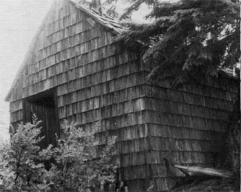
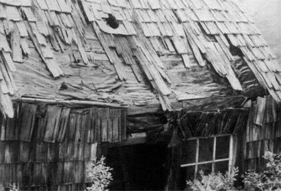
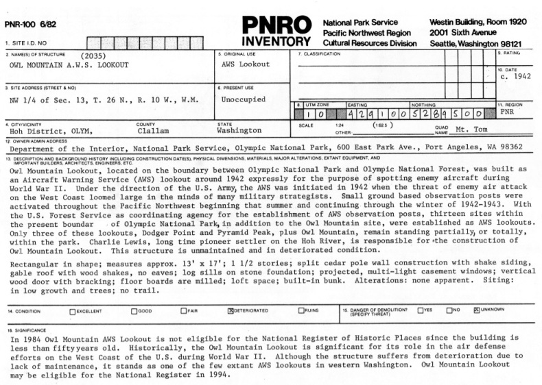
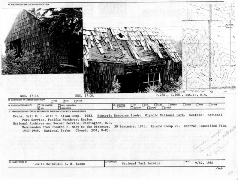
According to the "Historic Building Inventory Olympic National Park Washington" by Gail E. H. Evans, the long-time pioneer settler on the Hoh River, Charlie Lewis, is responsible for the construction of Owl Mountain Lookout. It was rectangular in shape, measures approx. 13 x 17 feet, 1 1/2 stories, split cedar pole wall construction with shake siding, gable roof with wood shakes, no eaves, log sills on stone foundation, projected, multi-light casement windows, vertical wood door with bracing, floor boards are milled, loft space, built-in bunk. The building was still standing in the 1980s. The historic building nomination was not submitted in 1984 because it was only 42 years old, and it needed 50.
The Lookout Structure
This list said to retain but gave no suggestion as to whom. Says it was on State Land and for some reason says it was an existing station that was winterized. Shows a shake cabin built of native material, 14 miles from the road. The DNR was pretty involved with the finding and building of this AWS site. I have no evidence to say whether it was used for fire.
May 1, 1944: Report of AWS sites at end of use. (see on the right)
Owl Ridge line was to be abandoned. Said that this line is of no further forest use.
May 23, 1944: Report of AWS phone lines at end of use.


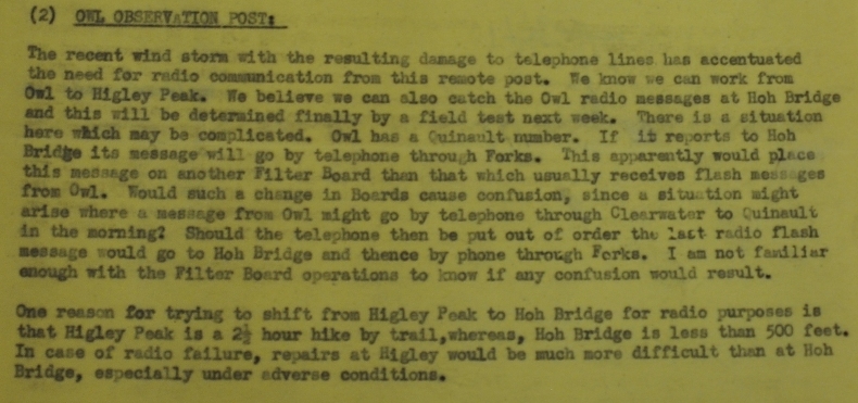
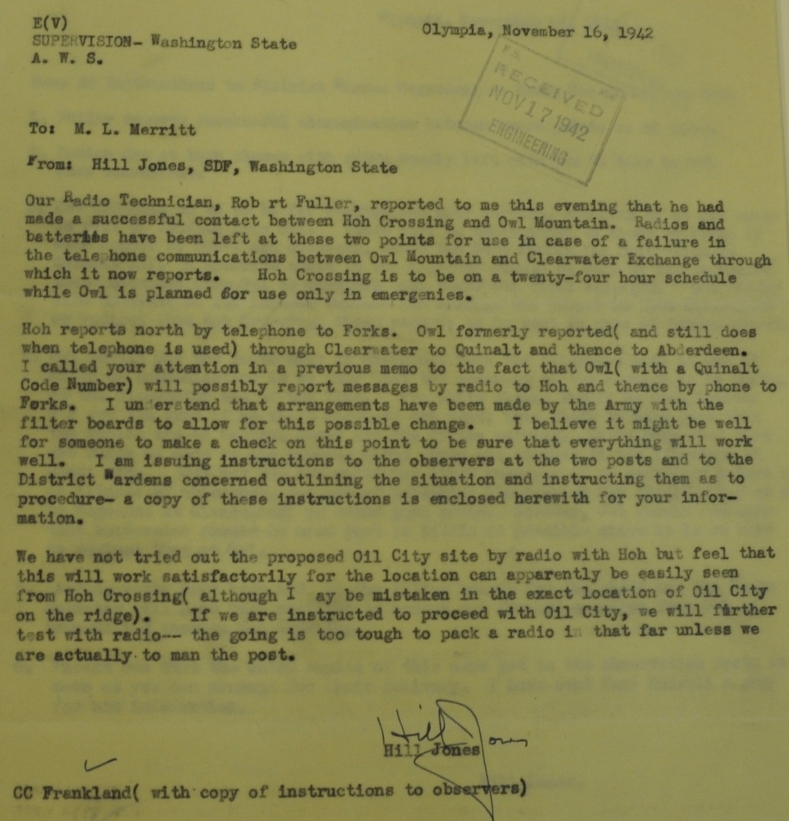
Nov. 6, 1942
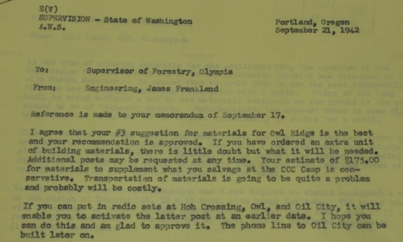

Nov. 1942
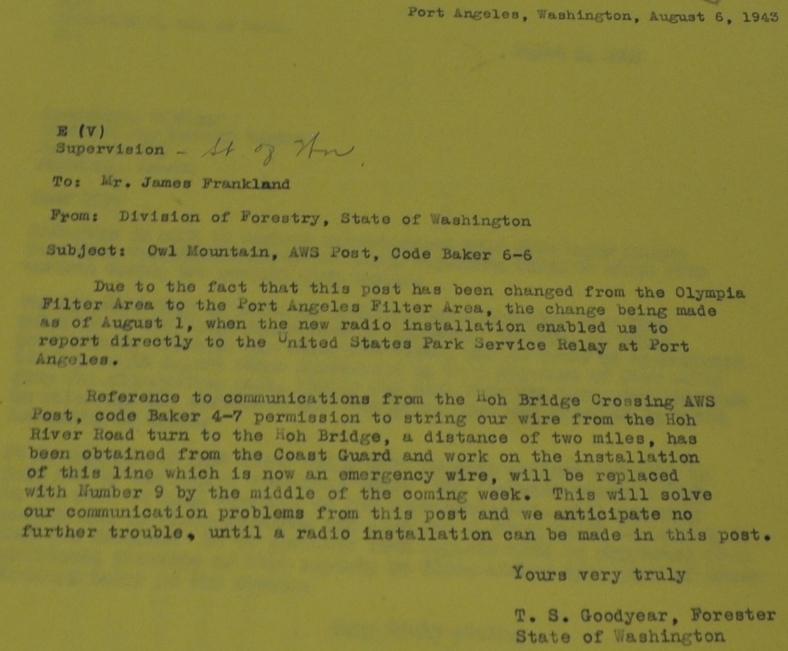
Below are more documents as discussions continued, mostly regarding communications for the Owl Ridge station.
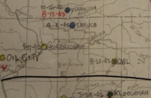
Located between Kloochman and Spruce with a date of Aug. 22, 1942
Located between Kloochman and Spruce
Probably early 1980s
Near E1/4 Corner of Section 14, Township 26 North, Range 10 West.
May 1, 1944: Report of AWS sites at end of use.
May 23, 1944 Report of AWS phone lines at end of use.
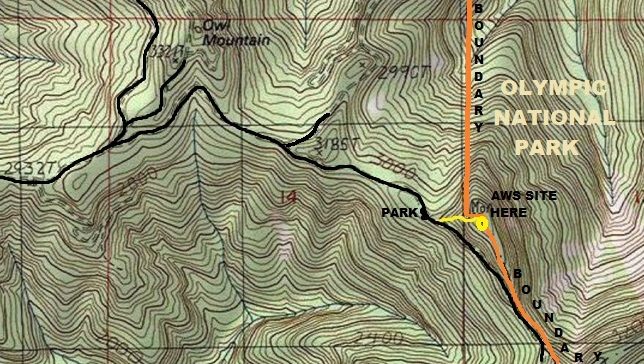
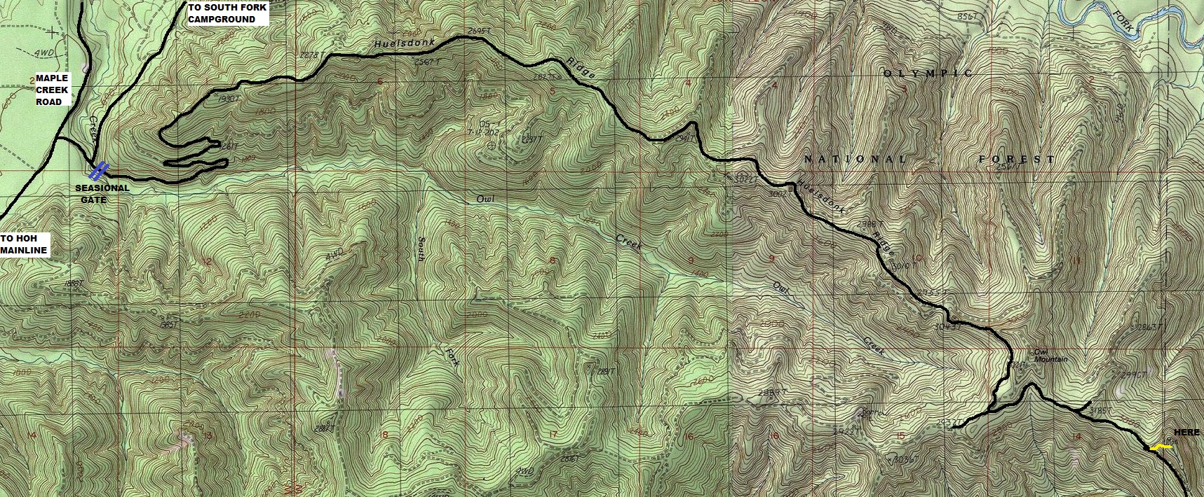
Access to the location of Owl Ridge AWS site. Seasonal gate is open in summer, I don't know the dates.
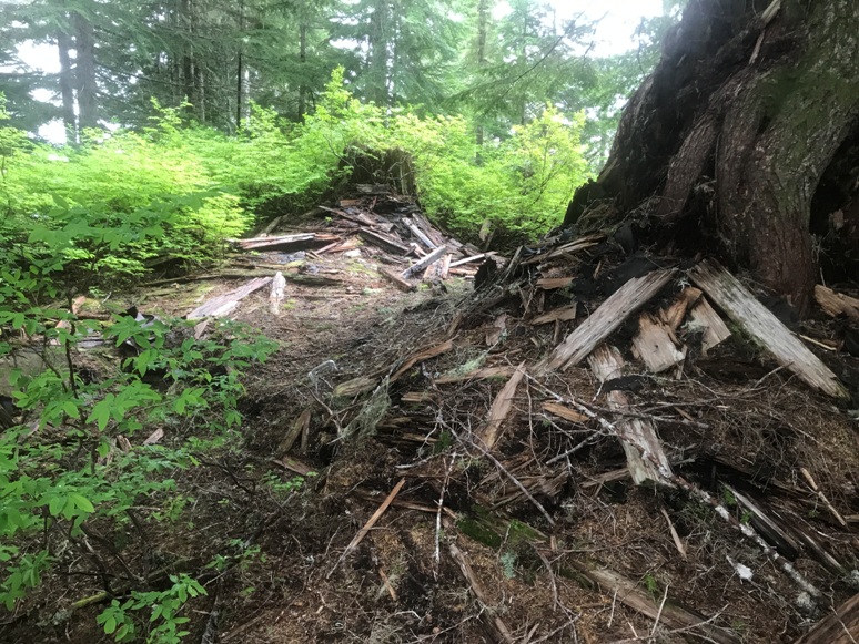
Structure in June 2020
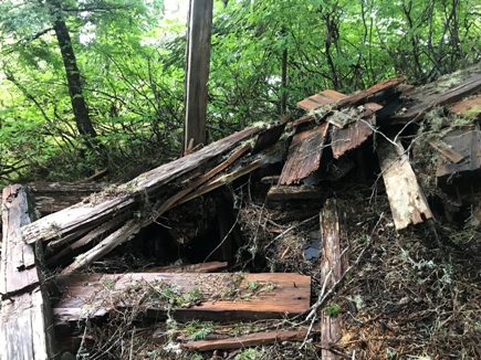
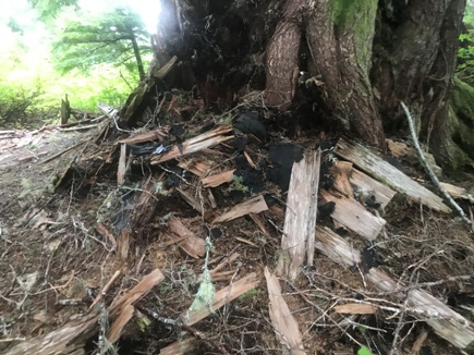
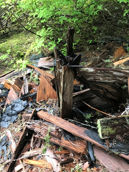
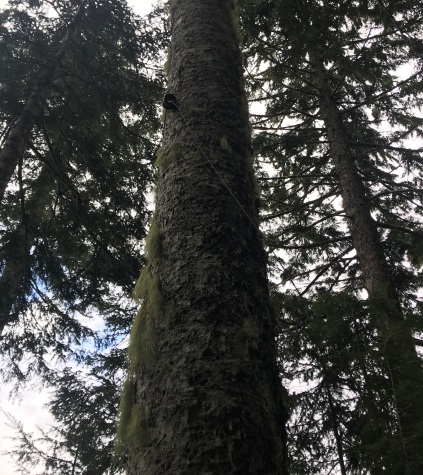
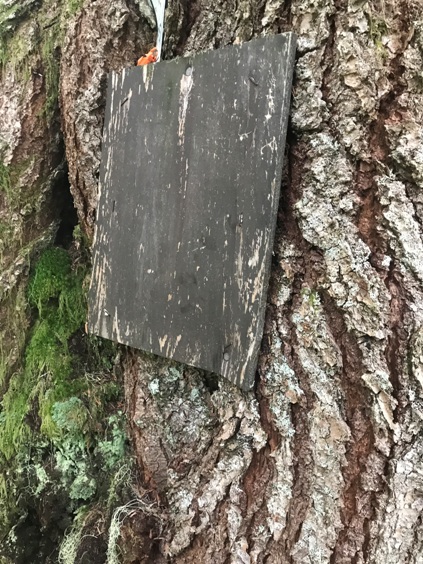
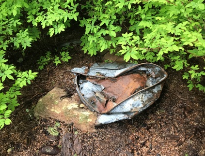
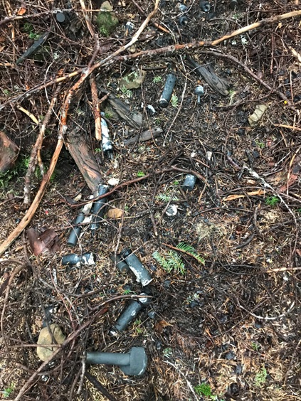
Board on the tree next to the building remains
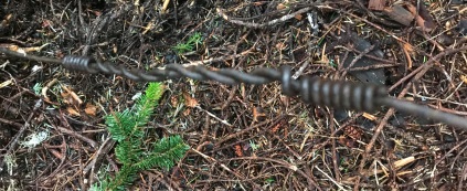
Phoneline and insulator
Remains
Remains up against the tree
Structure with the tree on the right
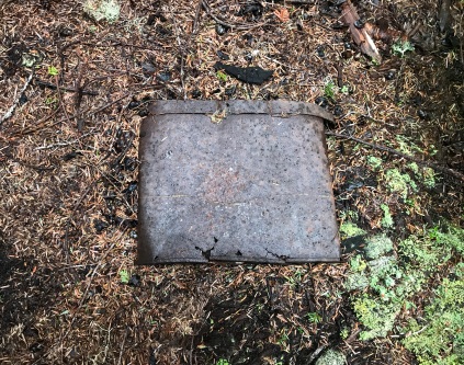
Battery dump
Remains
Crushed bucket
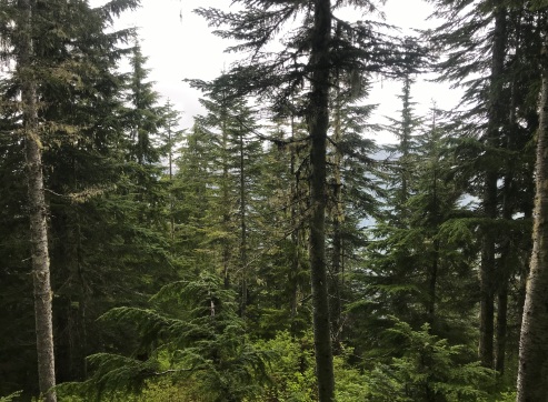
View in 2020
Map of the location today
Wire
Unknown
From Hwy 101, take the Hoh Mainline to the Maple Creek Road, follow to the H1000, take a right, then another right on the gated Huelsdonk Ridge Road. Use map and follow to site. Ridge road is a decent gravel road with some bumps.
Access:
Leave the road and bash your way a few feet into the forest. Once on the back side of the ridge, the forest is open. Work up the ridge in a second growth open forest. About halfway up, the forest turns to a mostly open old-growth forest. Follow ridge to summit. The old phone line can be found in many spots along the route.
Route:
1. We can handle the trail construction and will do so when you approve. A good horse trail from the flats of the Hoh to the point is estimated to take six weeks for ten men with a cost of $1500, the distance being about four miles by trail. Trail construction could be started as soon as approval is received. It will take two days for the crews to clear out an old Forest Service trail up the South Fork which must be done before the trail can be started for the peak.
2. I do not know what improvements you want at the peak but a tent and fly could be utilized until late fall. This would cost approximately $50.
3. An emergency line eleven miles long could be strung in advance of the trail construction to secure communication at an early date.
4. As I understand the radio communication could be established to Kloochman Peak by using a Forest Service type radio and on the Forest Service wave length. We have no radios in this area. The information would presumably be telephoned in from Kloochman Peak upon its receipt.
5. The felling of the timber on the Peak can be done while the trail construction is nearing the Peak. While we have not made arrangements with the State Land Commissioner it is believed that this permission can be secured.


